
Overnight snowfall is possible ahead of a weekend storm that will bring rain and possibly snow to millions up and down the East Coast and into parts of the Midwest.
Snow showers are possible in much of the Northeast Tuesday night, Dec. 5 into Wednesday, Dec. 6.
A separate ocean-effect system in Massachusetts and eastern Connecticut will bring the possibility of light snow, especially in the Boston area overnight.
A potential 2 inches of snowfall is possible in the Greater Boston area. (Click on the second image above from the National Weather Service.)
"The dry and increasingly mild conditions that will precede the upcoming storm this weekend will set the stage and provide the atmospheric fuel needed for what could end up being a highly disruptive storm," according to AccuWeather.com.
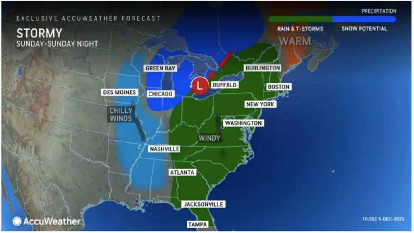
The current time frame for the storm is during the day on Sunday, Dec. 10, continuing into Sunday night, and possibly Monday, Dec. 11, the National Weather Service says.
If the storm were to lift up into Canada, residents across the interior Northeast can expect primarily rain, but if a more southern track were to occur, there could be a period when rain changes over to snow before coming to an end," AccuWeather says. " Along the East Coast, major cities from Washington, DC, to Boston will likely deal with all rain from this storm, some of which can be heavy between Sunday and Monday."
While there's uncertainty surrounding the track and precise timing of the system, one thing is certain. The days leading up to the storm's arrival will be seasonably cool with a mix of sun and clouds and daily high temperatures generally in the 40s, according to the National Weather Service.
The day before the storm arrives, Saturday, Dec. 9, the mercury will climb to a high temperature in the mid-50s with mostly cloudy skies.
Check back to Daily Voice for updates.
Click here to follow Daily Voice Suffolk and receive free news updates.