Find Your Daily Voice
Montgomery
Your Local News for Montgomery County, Maryland
Saturday, apr 27
61°
Follow
News
Schools
Business
Obituaries
Police & Fire
Weather
Lifestyle
Sports
Traffic
Tags
Jobs
Shop
Support Us
Montgomery
Follow
Find Your Daily Voice
News
Schools
Business
Obituaries
Police & Fire
Weather
Lifestyle
Sports
Traffic
Tags
Jobs
Shop
Support Us
Home
About us
All sites
Advertise with us
Contact us
Terms of use
Privacy policy
Code of ethics
Site Map
© 2024 Cantata Media
61°
Saturday, apr 27
Weather
Incoming Storm Means Slight Air Quality Improvement Along East Coast, Forecasters Say
A weekend storm could slightly help improve the Canadian wildfire smoke still lingering along the East Coast, meteorologists are saying. While skies will be sunny with a high in the mid-80s on Friday, June 30, they'll also be hazy for most of the day, according to the National Weather Service. The Air Quality Index remained in the triple digits along East Coast of 9:15 a.m., with code red issued across much of the area. In Pittsburgh, air quality levels remained very unhealthy, according to AccuWeather's Plume Labs. Worst air quality in this batch is just northwest of us and some spots…
Weather
Code Red: Some Masking Up After Air Quality Alerts Issued For All Of MD, Northern VA
Some residents in the DMV region are breaking their N95 masks out as the air quality throughout the region continues to deteriorate. A "Code Red" alert has been issued in the area as smoke from the Canadian wildfires continues to infiltrate the East Coast, causing eye-watering, hazy, and potentially dangerous conditions. Code Red Air Quality Alerts continue for all of MD, northern VA, and eastern WV through this afternoon as Canadian wildfire smoke filters into the region. The smoke lingers into Friday although improvements are likely with southerly winds. #MDwx #VAwx #DCwx #WVwx pic.…
Weather
DC Area Has 2nd Worst Air Quality In The World Today (June 29), Under Code Red
The Canadian wildfire smoke has descended upon the Washington DC area Thursday, June 29, which had the second-worst air quality in the world, according to iqair.com. The Metropolitan Washington Council of Governments issued a "code red" for Thursday. Chicago had the worst air quality in the world and Dubai had the third worst, according to iqair.com. 🔴Air Quality Alert: COG forecasts Code Red air quality for the DC region tomorrow, Thursday, June 29 due to smoke from wildfires in Canada. Area residents are encouraged to limit outdoor activities. Stay air quality aware: https://t.co/vujQ…
Weather
Air Quality Quickly Worsening As Wildfire Smoke Returns
Another wave of Canadian wildfire smoke is making its way to the East Coast — and things were already not looking great as of Wednesday, June 28. Air quality index (AQI) values were in the triple digits in Philadelphia, Washington DC, and Baltimore as of Wednesday afternoon, AccuWeather says citing Plume Labs (see map above). The AQI in Pittsburg was particularly bad, with levels reaching 285. Click here to watch the skyline vanish. ALSO SEE: Philadelphia Air Quality Hits Code Red Due To Canadian Wildfire Smoke, Officials Warn Worst day of smoke from the Canadian wildfires we’ve had y…
Weather
Air Quality To Get Worse Before It Gets Better In Maryland, Forecasters Say
Skies may be hazy in parts of Maryland as the wind shifts and brings smoke from the Canadian wildfires back to the area. Maryland is under an "Air Quality Alert" on Wednesday, June 28, and health officials are advising that some wear masks if they have to head outside to protect themselves. Maryland is under an Air Quality Alert, including a "Red" forecast for unhealthy air in Western Maryland. N95, KN95 and FFP2 masks reduce particles you breathe in. Even with a mask, consider limiting time outdoors during air quality alerts. pic.twitter.com/LcGFbavti3 — MD Environment (@MDEnvironment…
Weather
Severe Thunderstorm Warnings Issued For Parts Of DMV Region Amid Latest Bout Of Wild Weather
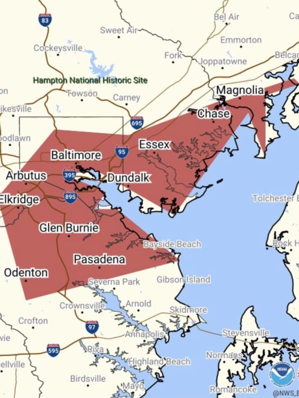
Some parts of the DMV region can expect extreme weather to continue as storms bringing hail and whipping winds continue to roll through the area. Some relief is on the horizon for residents in Maryland and Virginia, but not before Mother Nature goes one more round with winds reaching 60 mph and quarter-sized hail possible to fall in certain neighborhoods. Special Marine Warning including the Chesapeake Bay from Drum Point MD to Smith Point VA, Chesapeake Bay from North Beach to Drum Point MD, Chesapeake Bay from Sandy Point to North Beach MD and Choptank River to Cambridge MD and the Li…
Weather
Tornado, Hail Possible As Severe Weather Expected To Strike DMV Region
Severe thunderstorms bringing whipping winds and possibly hail to DC and Maryland are expected to rock the DMV region on Monday afternoon. A "severe weather outlook" has been issued for the entire region between 2 p.m. and 10 p.. on Monday, June 26 throughout the I-95 corridor, specifically during the evening commute, according to the National Weather Service. It will be an active weather day as severe thunderstorms are expected to impact areas east of the Alleghenies. These... Posted by US National Weather Service Baltimore/Washington on Monday, June 26, 2023 The storm is expected to …
Weather
Storms With Possibility Of Isolated Tornadoes To Threaten East Coast
Severe storms with the possibility of isolated tornadoes will be threatening the East Coast Monday, June 26, and will be followed by at least two more days of stormy weather, meteorologists say. Damaging winds, flash flooding, and hail are all possible by late in the afternoon Monday, forecasters are predicting. Hail could be around 1 inch in diameter, the National Weather Service said in a Hazardous Weather Outlook statement issued early Monday morning. A moderate threat was issued across North Jersey, the Poconos, and Central Pennsylvania, while a high threat was issued in South Jersey,…
Weather
Damaging Thunderstorms, Hail Could Be Heading To DMV Region
The National Weather Service is cautioning residents in the DMV region that some troubling storms could be coming to the area. An alert was issued on Sunday afternoon advising that there is "an increased confidence" that there will be severe thunderstorms with possible hail and damaging winds on Monday, June 26. The "weather threat" is listed between 2 p.m. and 6 p.m. for those east of I-95, while it is set between 4 p.m. and 9 p.m. east of the highway. According to weather officials, winds may reach upwards of 60 mph in some neighborhoods, and "large hail (is possible)" Some areas may…
Weather
Here's Cindy: New Tropical Storm Develops In Active Atlantic
It's starting to get crowded in the Atlantic basin. A brand-new tropical storm has formed just as an earlier system, Bret, continues its westward movement: Meet Cindy. As of around midday Friday, June 23, the center of Tropical Storm Cindy was about 900 miles east of the Lesser Antilles, according to the National Hurricane Center. Cindy is moving toward the west-northwest at around 16 miles per hour and this general motion is expected to continue over the next few days. Maximum sustained winds have increased to nearly 50 mph with higher gusts, the hurricane center sai…
Weather
Separate Rounds Of Thunderstorms Take Aim On Region
Bouts of rain showers and thunderstorms heading to the region are expected to make up for the abnormally-dry end of spring and start to summer. There will be scattered showers throughout the day on Thursday, June 22, which will be cooler with a high temperature in the mid-60s, according to the National Weather Service. About a quarter of an inch of precipitation is possible. Conditions will then become more stormy starting on Friday, June 23, which will be warmer and more humid with a high temperature in the mid-70s. See thunderstorms and rain being forecast along the East Coast.AccuW…
Weather
Newly-Formed Tropical System In Atlantic Expected To Become Hurricane
A new system that formed in the Atlantic basin is expected to strengthen to tropical storm status before possibly becoming the first hurricane of the 2023 season. Tropical Depression 3, which developed on Monday, June 19 in the central Atlantic, is expected to continue to move toward the west for the next several days, according to the National Hurricane Center. "The system should be approaching the Lesser Antilles late this week," said the hurricane center. "Maximum sustained winds are near 35 mph with higher gusts. Some strengthening is forecast, and the depression is forecast to be…
1
2
3
4
5
6
7
8
9
10
Archive