One-Week Forecast

  1. Current
     Fog/Mist 73°
    • 93°
    • 73°
    Fog/Mist
  2. Sat 08/08
    Chance Rain Showers
    • 89°
    • 71°
    Chance Rain Showers
  3. Sun 08/09
    Mostly Sunny
    • 89°
    • 66°
    Mostly Sunny
  4. Mon 08/10
    Partly Sunny
    • 89°
    • 69°
    Partly Sunny
  5. Tue 08/11
    Chance Rain Showers
    • 89°
    • 68°
    Chance Rain Showers
  6. Wed 08/12
    Slight Chance Rain Showers
    • 86°
    • 64°
    Slight Chance Rain Showers
  7. Thu 08/13
    Chance Rain Showers
    • 84°
    Chance Rain Showers
Torrential Rain, 70 MPH Gusts Main Threats As Severe Storm Shifts Toward Northeast Torrential Rain, 70 MPH Gusts Main Threats As Severe Storm Shifts Toward Northeast
Torrential Rain, 70 MPH Gusts Main Threats As Severe Storm Shifts Toward Northeast A steamy, unsettled pattern is setting the stage for a more concentrated round of dangerous weather across the Northeast. Scattered storms will remain possible into Thursday evening, Aug. 6, but attention is shifting to Friday, Aug. 7, when stronger thunderstorms could affect a heavily populated corridor from Washington, DC, and Baltimore through Philadelphia and New York City. The main dangers will be damaging wind gusts, torrential rain, frequent lightning, and localized flash flooding, according to AccuWeather. Some storms could produce wind gusts approaching 70 mph, enough to bring dow…
New Round Of Storms With Heavy Rain, Flash Flood Threat Near Northeast: Updated Timing New Round Of Storms With Heavy Rain, Flash Flood Threat Near Northeast: Updated Timing
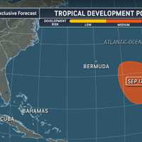
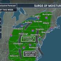
New Round Of Storms With Heavy Rain, Flash Flood Threat Near Northeast: Updated Timing A surge of moisture will fuel rounds of storms with drenching downpours and possible flash flooding. Click here for a new, updated story - Drenching Downpours Will Raise Flash-Flood Threat Across Northeast: Timing After scattered showers and storms on Wednesday evening, Aug. 5, warmer, more humid air will spread north along the East Coast on Thursday, Aug. 6, triggering storm activity. Highs will reach the mid- to upper 80s, with some interior locations nearing 90 degrees. A strengthening area of high pressure near Bermuda will help draw moisture northward, according to Ac…
Snow Totals Are In: Here’s Which Mass Towns Got Hit The Hardest Snow Totals Are In: Here’s Which Mass Towns Got Hit The Hardest
Snow Totals Are In: Here’s Which Mass Towns Got Hit The Hardest The Northeast is digging out, and the snow totals are in. By 1 a.m. Monday, Jan. 26, the National Weather Service issued updated storm-total snowfall reports across New Jersey, New York, and Connecticut as the system wrapped up. Many communities finished in the double digits, with the highest totals pushing past 17 inches in parts of the region, according to the National Weather Service. Connecticut FAIRFIELD COUNTY New Fairfield: 16.0 in at 10:09 p.m. Bethel: 15.7 in at 10:27 p.m. Danbury: 15.5 in at 10:45 p.m. Bridgeport Airport: 15.1 in at 12:00 a.m. Greenwich: 11.0 in at 6:38 p.m. N…