

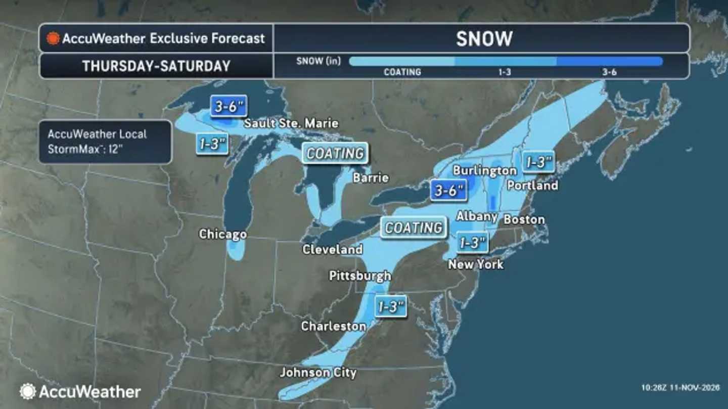


The National Weather Service expects rain across much of the region from Thursday, Nov. 12, through Saturday, Nov. 14, with wet snow developing in higher terrain. Elevation and the arrival of colder air will determine where snow sticks.
AccuWeather’s snowfall map projects a coating across portions of the interior, with 1 to 3 inches in selected mountain areas and pockets of 3 to 6 inches farther north, including parts of northern New England.
Mount Pocono, Pennsylvania, and Saranac Lake, New York, could receive a slushy coating to a few inches. The highest ridges could collect more, with heavy, wet snow creating a risk of broken branches and isolated power outages.
The NWS Boston office expects the Berkshires and Worcester Hills to turn snowy as early as Thursday night. However, it anticipates only minor accumulation in the highest terrain, with cold rain prevailing across most of Massachusetts and Connecticut.
Across Maryland and northern Virginia, showers spread east Thursday. The Alleghenies could change from rain to a mix Thursday night, then snow Friday, Nov. 13. Accumulation is most likely above 3,000 feet, especially Friday night as temperatures fall.
New York City, northeastern New Jersey, and coastal Connecticut face mainly rain. The NWS projects 0.5 to 1.5 inches, with isolated totals of 2 to 3 inches possible.
A brief rain-snow mix could reach higher elevations far north and west of the city Friday night. Minor coastal flooding is possible during Thursday’s and Friday’s daytime high tides.
AccuWeather expects Nor’easter conditions to develop only as the storm begins moving away. It says cooling within the storm, rather than an incoming Arctic air mass, will help produce mountain snow.
Blustery weather follows. Its Saturday graphic shows feels-like highs near freezing in Pittsburgh and the mid-30s in Boston, distinct from actual air temperatures.
Rain, low clouds, and inland snow could slow travel before conditions gradually improve.
Check back to Daily Voice for the latest updates.
Click here to follow Daily Voice and receive free news updates.
