One-Week Forecast

  1. Current
    A Few Clouds 71°
    • 84°
    • 69°
    A Few Clouds
  2. Wed 08/05
    Chance Rain Showers
    • 84°
    • 73°
    Chance Rain Showers
  3. Thu 08/06
    Chance Thunderstorms
    • 89°
    • 75°
    Chance Thunderstorms
  4. Fri 08/07
    Chance Thunderstorms
    • 89°
    • 75°
    Chance Thunderstorms
  5. Sat 08/08
    Chance Thunderstorms
    • 89°
    • 75°
    Chance Thunderstorms
  6. Sun 08/09
    Chance Rain Showers
    • 87°
    • 75°
    Chance Rain Showers
  7. Mon 08/10
    Partly Sunny
    • 89°
    Partly Sunny
Here's When LI's Air Will Improve And How To Check Your Town's Forecast Here's When LI's Air Will Improve And How To Check Your Town's Forecast
Here's When LI's Air Will Improve And How To Check Your Town's Forecast Long Islanders dealt with another day of nasty air quality due to Canadian wildfires on Thursday, July 16. While official air quality readings were in the “moderate” and “unhealthy for sensitive groups” range in the early afternoon, photos from across the region showed smoky skies and a bizarre, orange-colored sun. Additionally, the air quality was expected to get worse throughout the day Thursday, with PM2.5 readings predicted to hit 185 by the evening — well into the “unhealthy range,” according to the U.S. Air Quality Index. For at least the fourth straight summer, the nasty skies were …
Wind Advisory Issued For LI As Strong Storm Brings Gusts Up To 50 MPH Wind Advisory Issued For LI As Strong Storm Brings Gusts Up To 50 MPH
Wind Advisory Issued For LI As Strong Storm Brings Gusts Up To 50 MPH A Wind Advisory is in effect for Westchester County and Long Island as a powerful storm system moves through the region, bringing strong winds that could down tree limbs and cause scattered power outages.   The National Weather Service said the advisory will take effect at 2 p.m. on Monday, March 16, and last through 4 a.m. on Tuesday, March 17.   During that time, south winds of 20 to 30 mph with gusts up to 50 mph are expected across parts of the Lower Hudson Valley, including southern Westchester, as well as Suffolk and Nassau counties.  Forecasters warn that th…
Latest Town-By-Town Snowfall Totals As Massive Storm Slams Long Island, Tristate Latest Town-By-Town Snowfall Totals As Massive Storm Slams Long Island, Tristate
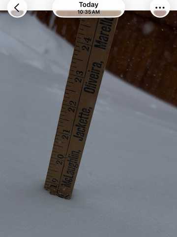
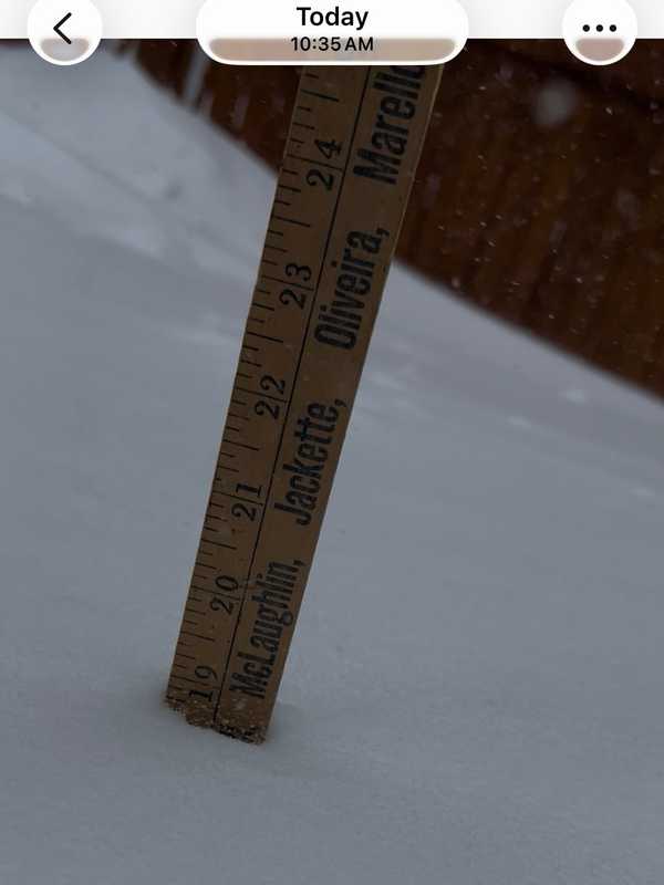
Latest Town-By-Town Snowfall Totals As Massive Storm Slams Long Island, Tristate Here's a rundown of updated snowfall totals from downstate New York, northern New Jersey, and Connecticut for a historic, massive Nor'easter that arrived Sunday night, Feb. 22, continuing into Monday, Feb. 23. Some spots had already seen as much as 20 inches by mid-morning Monday, and approached 30 inches later in the day. Central Park in Manhattan recorded 19.7 inches, making it the heaviest snowstorm for the city in over five years and nearly approaching all-time records. Over 650,000 customers lost power across the region, with the heaviest outages concentrated in New Jersey, Massachuse…
Winter Storm Watch Issued for Hudson Valley, LI: Up To 13 Inches Of Snow Forecasted Winter Storm Watch Issued for Hudson Valley, LI: Up To 13 Inches Of Snow Forecasted
Winter Storm Watch Issued for Hudson Valley, LI: Up To 13 Inches Of Snow Forecasted A Winter Storm Watch has been issued for parts of the Hudson Valley, New York City, and Long Island as a strengthening storm system could bring heavy snow and strong winds to the region late this weekend.  The National Weather Service in New York said the watch is in effect from Sunday morning, Feb. 22, through Monday afternoon, Feb. 23, for portions of southeast New York, including Orange, Putnam, Rockland, Westchester, New York City, and Nassau and Suffolk counties on Long Island.   Forecasters say 6 to 10 inches of snow are possible, along with wind gusts up to 40 mph. Tra…
Iconic Hamptons 'Stilt House' Collapses Into Icy Bay Amid Deep Freeze Iconic Hamptons 'Stilt House' Collapses Into Icy Bay Amid Deep Freeze
Iconic Hamptons 'Stilt House' Collapses Into Icy Bay Amid Deep Freeze A beloved Hamptons landmark that stood above the water for generations collapsed into the bay after days of bitter cold. Amagansett’s famed “stilt house” in the Lazy Point section collapsed overnight Sunday, Feb. 1, after frigid temperatures froze the waters beneath it, snapping the wooden posts that had held it aloft for more than 70 years. Photos from the scene show the once-elevated home now partially submerged in ice-choked waters of Gardiners Bay, where it had long stood isolated above the water. Montauk photographer James Katsipis, who has photographed the house for more than two dec…
Snow Much Scrutiny: Mamdani, Hochul—Even Ted Cruz—Dug Into Shoveling Drama Snow Much Scrutiny: Mamdani, Hochul—Even Ted Cruz—Dug Into Shoveling Drama
Snow Much Scrutiny: Mamdani, Hochul—Even Ted Cruz—Dug Into Shoveling Drama New York’s biggest winter storm in years proved once again that on the internet, everyone’s an expert. NYC Mayor Zohran Mamdani helped Brooklyn residents dig out from this weekend’s massive winter storm, but he quickly drew online fire, not for his politics but for his technique. Mamdani was photographed by ABC7 Sunday, Jan. 25, pitching in as Winter Storm Fern buried parts of the city under more than 11 inches of snow. But it wasn’t long before social media users zoomed in on how he was shoveling — and many were not impressed. Several commenters pointed out that Mamdani appeared to be twi…
Hochul’s Snow Shoveling Tips Spark Laughs — And A Serious Reminder: 'You Don't Want That!' Hochul’s Snow Shoveling Tips Spark Laughs — And A Serious Reminder: 'You Don't Want That!'
Hochul’s Snow Shoveling Tips Spark Laughs — And A Serious Reminder: 'You Don't Want That!' As New Yorkers began to dig out from the biggest winter storm in years, Gov. Kathy Hochul reminded residents to shovel smart and don’t overdo it. In a PSA posted Monday, Jan. 26, Hochul — a Buffalo native — demonstrated what she described as the “right way” to shovel snow, drawing on her Western New York roots. “Easy does it,” Hochul said in the video. “Just push it out of the way. No strain on the back from doing that,” she explained while showing proper form. When snow gets heavier, Hochul advised breaking it into smaller sections rather than lifting large loads. “Don’t do a bi…
How Much Snow Did You Get? These Nassau County Locales Saw Highest Totals: New Update How Much Snow Did You Get? These Nassau County Locales Saw Highest Totals: New Update
How Much Snow Did You Get? These Nassau County Locales Saw Highest Totals: New Update Here are snowfall totals from the National Weather Service for the major winter storm that hit the region early Sunday morning, Jan. 25. A widespread foot or more of accumulation has been reported just before daybreak on Monday, Jan. 26. New York Manhattan Central Park 11.4 in 1200 AM 01/26 Official NWS Obs Queens JFK 10.3 in 1200 AM 01/26 Official NWS Obs La Guardia 9.7 in 1200 AM 01/26 Official NWS Obs Bronx  W Throgs Neck Bridge 12.5 in 1105 PM 01/25 Trained Spotter Brooklyn Williamsburg …
Snow Totals Are In: Here’s Which Long Island Towns Got Hit The Hardest Snow Totals Are In: Here’s Which Long Island Towns Got Hit The Hardest
Snow Totals Are In: Here’s Which Long Island Towns Got Hit The Hardest The Northeast is digging out, and the snow totals are in. By 1 a.m. Monday, Jan. 26, the National Weather Service issued updated storm-total snowfall reports across New Jersey, New York, and Connecticut as the system wrapped up. Many communities finished in the double digits, with the highest totals pushing past 17 inches in parts of the region, according to the National Weather Service. Connecticut FAIRFIELD COUNTY New Fairfield: 16.0 in at 10:09 p.m. Bethel: 15.7 in at 10:27 p.m. Danbury: 15.5 in at 10:45 p.m. Bridgeport Airport: 15.1 in at 12:00 a.m. Greenwich: 11.0 in at 6:38 p.m. N…
Final Post-Christmas Storm Update: These Locales On Long Island, In Region Saw Most Snowfall Final Post-Christmas Storm Update: These Locales On Long Island, In Region Saw Most Snowfall
Final Post-Christmas Storm Update: These Locales On Long Island, In Region Saw Most Snowfall Here's a newly updated rundown of snowfall accumulation reports compiled by the National Weather Service for the winter storm that arrived late Friday afternoon, Dec. 26, and lasted until Monday morning, Dec. 27.  The highest reported totals of 9-10 inches of accumulation came mainly from the Hudson Valley and northwestern Connecticut. Related story - Second Storm In Days Will Bring Heavy Rain, Icy Mix, Gusty Winds To Northeast: Here's Timing New York Manhattan Central Park 4.3 in 0700 AM 12/27 Official NWS Obs Bronx NNE Fordham 4.3 in 0400 AM 12/27 Public Brooklyn…
State Of Emergency Declared In NY As Heavy Snow Targets Hudson Valley, NYC, Long Island: Hochul State Of Emergency Declared In NY As Heavy Snow Targets Hudson Valley, NYC, Long Island: Hochul
State Of Emergency Declared In NY As Heavy Snow Targets Hudson Valley, NYC, Long Island: Hochul New York Gov. Kathy Hochul has declared a State of Emergency as a major winter storm threatens to bring heavy snowfall, dangerous travel conditions, and possible power outages across much of New York — including the Hudson Valley, New York City, and Long Island.  The emergency declaration, announced on Friday afternoon, Dec. 26, covers more than 40 counties, including Dutchess, Orange, Putnam, Rockland, Ulster, Columbia, Greene, Albany, Nassau, Suffolk, Rensselaer, Saratoga, and Westchester counties, as forecasters warned of four to eight inches of snow across the Mid-Hudson region and …
Freeze Warning Issued For Lower Hudson Valley, Long Island, NYC Freeze Warning Issued For Lower Hudson Valley, Long Island, NYC
Freeze Warning Issued For Lower Hudson Valley, Long Island, NYC Bundle up, New Yorkers — the first widespread freeze of the season is on the way.  The National Weather Service has issued a Freeze Warning for large portions of southeast New York, including New York City, Long Island, Westchester County, and parts of the Hudson Valley, effective from 1 a.m. to 9 a.m. on Tuesday, Nov. 11.  Forecasters say temperatures will fall to between 30 and 32 degrees, which could kill crops and other sensitive plants. According to the NWS, the warning covers southern Westchester County, New York City, and Nassau and Suffolk counties.  Residents …
Utility Crews Preparing For High Wind Event In Hudson Valley, Long Island: Advisory Issued Utility Crews Preparing For High Wind Event In Hudson Valley, Long Island: Advisory Issued
Utility Crews Preparing For High Wind Event In Hudson Valley, Long Island: Advisory Issued Utility crews in the Hudson Valley are preparing for a blustery night ahead, as the National Weather Service issues a Wind Advisory warning of gusts up to 45 miles per hour overnight Wednesday, Nov. 5, through early Thursday, Nov. 6.  The advisory, in effect from 9 p.m. Wednesday to 8 a.m. on Thursday, covers Orange, Rockland, Putnam, and northern Westchester counties, along with parts of southern Connecticut and northern New Jersey. A separate advisory also covers Nassau and Suffolk counties.  Forecasters said sustained west winds of 15 to 25 mph could bring down tree limbs and c…
High Wind Watch Issued For Long Island, Hudson Valley, NYC: Gusts Up To 60 MPH Possible High Wind Watch Issued For Long Island, Hudson Valley, NYC: Gusts Up To 60 MPH Possible
High Wind Watch Issued For Long Island, Hudson Valley, NYC: Gusts Up To 60 MPH Possible The National Weather Service has issued a High Wind Watch for much of the Hudson Valley, New York City, and Long Island, warning of potentially damaging gusts into Thursday morning, Nov. 6.  According to the alert, issued just before 1 p.m. on Tuesday, Nov. 4, west winds of 20 to 30 mph are expected, with gusts possibly reaching 60 mph in some areas, including Orange, Putnam, Rockland, Suffolk, Nassau, and Westchester counties.  The NWS warns that the powerful winds could knock down trees and power lines, leading to widespread outages and hazardous travel conditions — especially f…
Here Are NY Rain Totals From Nor’easter That Drenched Hudson Valley, Long Island Here Are NY Rain Totals From Nor’easter That Drenched Hudson Valley, Long Island
Here Are NY Rain Totals From Nor’easter That Drenched Hudson Valley, Long Island The powerful Nor’easter that swept up the East Coast brought drenching downpours across New York, soaking parts of the Hudson Valley and Long Island with more than three inches of rain.  As of 10:30 a.m. Tuesday, Oct. 14, the highest total was 3.47 inches in Port Jefferson Station, Suffolk County. Heavy rain also fell across Westchester, Putnam, and Rockland counties, where several communities topped 2 inches, according to data released by the National Weather Service.  The slow-moving storm brought flooding, strong onshore winds, and coastal erosion before moving offshore Tuesday…
Scorching Heat, Bad Air Quality Grips Region: Alerts Issued For Long Island Scorching Heat, Bad Air Quality Grips Region: Alerts Issued For Long Island
Scorching Heat, Bad Air Quality Grips Region: Alerts Issued For Long Island Residents across much of the Hudson Valley, Long Island, and New York City are under dual weather alerts on Wednesday, July 16, as officials warn of dangerous heat and elevated air pollution levels. The National Weather Service has issued a Heat Advisory from 11 a.m. on Wednesday through 10 p.m. Thursday, July 18, warning that heat index values could soar to 100 degrees in parts of:  Rockland, Westchester, Orange, and Putnam counties; New York City; Northern and Southern Nassau County; Suffolk County. Forecasters say the dangerous mix of high heat and humidity could cause heat-related…
Air Quality Alert In Effect For Parts Of Nassau: Here's When It Ends Air Quality Alert In Effect For Parts Of Nassau: Here's When It Ends
Air Quality Alert In Effect For Parts Of Nassau: Here's When It Ends If the air feels a little heavier today, you're not imagining it.  A health advisory for elevated air pollution levels remains in effect through 11 p.m. today, Wednesday, June 25, across much of the Hudson Valley, New York City, Long Island, and parts of the lower Hudson region.  The alert, issued by the New York State Department of Environmental Conservation, includes Westchester, Rockland, and all five boroughs, as well as Nassau and Suffolk counties. The concern: elevated levels of ground-level ozone, a pollutant that can make the air hazardous to breathe — especially for people with ast…
Nassau County Faces Air Quality Alert As Temps Climb Into 90s Thursday Nassau County Faces Air Quality Alert As Temps Climb Into 90s Thursday
Nassau County Faces Air Quality Alert As Temps Climb Into 90s Thursday It’s not just hot — it’s hazardous. Air quality across New Jersey and New York is expected to be unhealthy for sensitive groups on Thursday, June 12, as temperatures climb into the 90s and Code Orange Alerts are in effect. Health officials say that ground-level ozone and fine particulates will combine with heat to pose risks for children, seniors, and people with heart or lung conditions. ⚠️ Air Quality Alerts Code Orange Air Quality Alerts issued by the NJ Department of Environmental Protection Counties affected: Bergen, Essex, Union, Hudson, Passaic, Middlesex, Mercer, Ocean, Burling…
Tornado Confirmed In NY During Severe Storms: Here's When, Where Tornado Confirmed In NY During Severe Storms: Here's When, Where
Tornado Confirmed In NY During Severe Storms: Here's When, Where A tornado touched down in New York during a round of storms on Monday, June 9. The National Weather Service in Buffalo investigated storm-related damage from a rotating thunderstorm that affected the area around Great Valley in Cattaraugus County late in the afternoon. The tornado had peak winds of 110 miles per hour and was rated an EF-1 twister, the second-weakest of the six levels on the Enhanced Fujita damage scale. The twister had a path of 2.7 miles from 5:37 p.m. to 5:41 p.m. Several homes, garages, and structures lost walls and roofs. There was also significant …
How Much Snow Did You Get? A Look At Accumulation Totals From Long Island How Much Snow Did You Get? A Look At Accumulation Totals From Long Island
How Much Snow Did You Get? A Look At Accumulation Totals From Long Island Here's a look at snowfall accumulation totals from throughout the region released by the National Weather Service for the storm that moved through Saturday night, Feb. 8 into Sunday, Feb. 9. Location Amount Time/Date Provider New York Westchester County 1 N Eastchester 4.8 inches 0810 AM 02/09 Public Mamaroneck 4.8 inches 0630 AM 02/09 Public 1 SSE Port Chester 4.6 inches 0715 AM 02/09 Public 1 ESE Hartsdale 4.5 inches 1000 AM 02/09 Trained Spotter 2 N Mamaroneck …
How Much Snow Did You Get? Here Are Totals From Nassau County How Much Snow Did You Get? Here Are Totals From Nassau County
How Much Snow Did You Get? Here Are Totals From Nassau County Here's a look at snowfall totals reported by the National Weathe Service from throughout the region from the storm system that swept through Thursday, Nov. 21 into Friday, Nov. 22. New York New York City Central Park 1.86 in 0940 AM 11/22 AWS Nassau County Oyster Bay 2.25 in 0930 AM 11/22 CWOP Locust Valley 0.3 E 2.21 in 0910 AM 11/22 COCORAHS Albertson 0.2 SSE 2.09 in 0730 AM 11/22 COCORAHS Syosset 2.08 in 0800 AM 11/22 COOP Herricks 1.92 in 0830 AM 11/22 COCORAHS Port Washington 0.8 N 1.84 in 0719 AM 11/22 COCORAHS Massapequa 1.1 SE 1.80 in 0700 AM 11/22 COCORAHS Malverne 0.5 SE…
New Tornado Confirmed Amid Record-Setting Year In NY: Here's When, Where New Tornado Confirmed Amid Record-Setting Year In NY: Here's When, Where
New Tornado Confirmed Amid Record-Setting Year In NY: Here's When, Where A new tornado just touched down in New York in what has been a historic year for twisters in the state. There have now been 29 tornadoes in New York this year, breaking the record of 25 in 1992. A National Weather Service Storm Survey Team examined several reports of damage in Allegany County, in the towns of Wirt and Friendship, located near Buffalo, after the incident happened in the middle of the evening on Friday, Sept. 6. "The damage found was consistent with a tornado, with several areas of concentrated and extensive tree damage," the weather service said. The tornado had peak wind…
'We Will Rebuild': Powerful Storm, Flooding Leave Trail Of Destruction Across Long Island 'We Will Rebuild': Powerful Storm, Flooding Leave Trail Of Destruction Across Long Island
'We Will Rebuild': Powerful Storm, Flooding Leave Trail Of Destruction Across Long Island At least six homes were heavily damaged and roads were washed out following a powerful storm system that brought drenching rain and widespread flooding to parts of New York and Connecticut. On Long Island, Suffolk County Executive Ed Romaine issued a state of emergency on Monday, Aug. 19, after surveying flood damage caused when up to nine inches of rain fell in parts of the county overnight. “Our longtime Mill Pond is gone. Six houses along here were damaged, their cesspools and personal belongings are now floating down this creek into the sound,” Romaine told reporters. Earlier Report:…
Wildfire Smoke Drifting Into NJ/NYC: How Bad Will It Be? Wildfire Smoke Drifting Into NJ/NYC: How Bad Will It Be?
Wildfire Smoke Drifting Into NJ/NYC: How Bad Will It Be? If things looks fuzzier than usual, it wasn't your eyes focusing to adjust this morning. That was wildfire smoke is drifting from Canada into the Northeast, the National Weather Service said Wednesday morning, Aug. 14. "You may notice hazy skies today," the NWS New York office said. "It is coming from wildfire smoke, which has overspread across the area from north to south." While the smoke is expected to "stick around" for the next several days, forecasters are not expecting harmful impacts to the air quality, the NWS said. You may notice hazy skies today. It is coming from wildfire …
2 Tornadoes Confirmed In NY This Week: Here's When, Where 2 Tornadoes Confirmed In NY This Week: Here's When, Where
2 Tornadoes Confirmed In NY This Week: Here's When, Where A pair of new tornadoes have been confirmed in New York this week. Both occurred upstate on Wednesday, July 24, and they come after 10 twisters hit central and northern New York last week. In Oswego County, the first tornado on Wednesday touched down just before 3:30 p.m. in the town of Orwell, about 40 miles north of Syracuse. It left a short, coherent path of broken tree limbs extended down an east-west path and had peak winds of 85 miles per hour, ranking it as an EF-0 tornado, the weakest of six levels on the Enhanced Fujita Scale, according to the National Weather Service. The o…