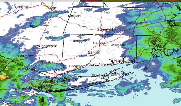
A widespread 1 to 1 1/2 inches of rainfall is expected from the system, with locally higher amounts of around 2 inches that could cause localized flooding, the National Weather Service said.
Rainfall will continue into around mid-morning Thursday, Dec. 28. (See the second image above from AccuWeather.com.)
Thursday will be mostly cloudy and mild with a high temperature around 50 degrees and a chance for showers, with a new, brief round of steady rain expected Thursday evening.
Friday, Dec. 29 will start with areas of fog on a cooler day with high temperatures in the upper 40s to around 50 degrees. Overall, it should be a mainly dry day precipitation-wise, but there could be a spotty shower or rainfall at times.
Saturday, Dec. 30 will be cloudy with possible peeks of sun and a high temperature generally in the low to mid-40s. A scattered shower can't be ruled out.
The unsettled stretch will finally end just as New Year's Eve comes on Sunday, Dec. 31.
Sunday will be mostly sunny and brisk with a high temperature in the low 40s.
The unsettled stretch will finally end just as New Year's Eve comes on Sunday, Dec. 31.
Sunday will be partly sunny and brisk with a high temperature in the low 40s.
For the dropping of the ball down the flagpole at Times Square starting right at 11:59 p.m. Sunday, look for mainly clear skies with a temperature right around the freezing mark as the ball completes its descent at midnight on Monday, Jan. 1.
Check back to Daily Voice for updates.
Click here to follow Daily Voice Brentwood and receive free news updates.

