
And it's no April Fools' joke.
There will be rain throughout the day Tuesday, April 2, and Wednesday, April 3 with a high temperature in the mid-40s both days.
About 1.5 inches of precipitation is projected for Tuesday, which will be blustery with wind speeds in the teens and gusts up to 20 to 25 miles per hour.
Approximately three-quarters of an inch to an inch of rain is predicted for Wednesday, with locally higher amounts as the midweek storm moves eastward.
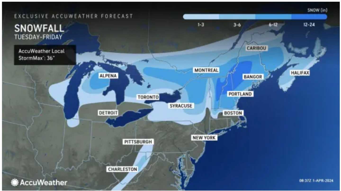
Snow is expected Wednesday night, April 3 into Thursday, April 4 in a wide part of the Northeast displayed in blue in the first image above with significant snowfall possible in areas shown in dark blue.
“There will be enough cold air in place that snowflakes could mix in all the way to Boston by late Wednesday into Thursday with some accumulations possible across the Worcester Hills,” said AccuWeather Senior Meteorologist Dan Pydynowski.
Areas in northern New England, the darkest shade of blue in the first image above could see between 12 and 24 inches of snowfall.
In upstate New York and parts of Western Massachusetts, 6 to 12 inches of accumulation is possible, with a widespread 1 to 6 inches in other areas shown in the two lightest shades of blue.
Precipitation is expected to wind down as rain for most of the Northeast by early Thursday afternoon.
It will be mostly cloudy throughout the day Thursday with a high temperature climbing into the mid-40s.
Check back to Daily Voice for updates.
Click here to follow Daily Voice Brentwood and receive free news updates.