
Ahead of the arrival of the system, it will be colder, bright, blustery, and brisk on Thursday, March 21 with plenty of sunshine and a high temperature in the low 40s, according to the National Weather Service.
Gusts will be as strong as 25 miles per hour, leading to wind-chill values in the upper teens to mid-20s.
It will remain clear on Friday, March 22 with a high temperature in the low 40s, but strong winds making it feel like it's in the 20s.
A new cold front will move through overnight into Saturday, March 23, bringing widespread rain with a mix of rain and snow likely farther inland.
"The northern part of the storm will bring more wintry conditions with snow or a combination of snow and rain to inland areas of northern Pennsylvania, upstate New York and New England," said AccuWeather Meteorologist Dean DeVore.
The window for snow and sleet in inland areas is from about 2 a.m. to 8 a.m. Saturday. Little or no accumulation is expected.
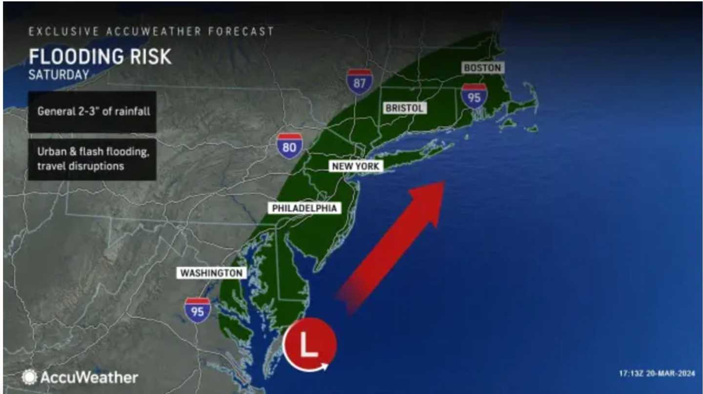
Areas where there is a wintry mix will see rainfall during the day Saturday, with to 2 inches of precipitation expected, with locally higher amounts. Flooding is possible over a broad area in the Northeast but is most likely along coastal areas. (See the first image above.)
Rain will be heavy at times during the day on Saturday with blustery conditions. The strongest wind gusts are expected Saturday night.
Overnight Saturday into Sunday, March 24, rain could again mix with light snow before the system winds down shortly after daybreak on Sunday.
Skies will gradually become partly sunny Sunday. It will be breezy with a high temperature in the mid-40s.
The outlook for Monday, March 25 calls for mostly sunny skies and a high temperature of around 50 degrees.
Check back to Daily Voice for updates.
Click here to follow Daily Voice Brentwood and receive free news updates.