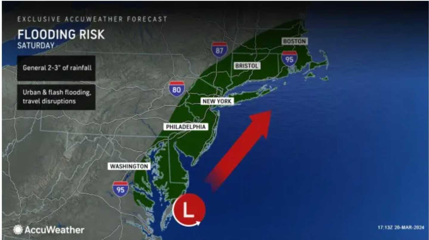

The timing for the system is late Friday night, March 22 into late Saturday night, March 23. A widespread 2.5 to 3.5 inches of rainfall is now expected, with local higher amounts possible.
"Excessive runoff may result in flooding of rivers, creeks, streams, and other low-lying and flood-prone locations," according to the National Weather Service. "Creeks and streams may rise out of their banks. Flooding may occur in poor drainage and urban areas."
The system will be ignited by a cold front that will move through overnight into Saturday.
Areas farther inland will see a mix of rain, sleet, and snow overnight.
The window for snow and sleet in inland areas is from about 2 a.m. to 8 a.m. Saturday. Little or no accumulation is expected.
Rain will be heavy at times during the day on Saturday with blustery conditions.
The strongest wind gusts of about 30 miles per hour are expected Saturday night. Gusts could be as high as 45 mph along the coast.
"The combination of the rain, a low cloud ceiling, and gusty winds will likely lead to airline delays and flight cancellations into the first part of the weekend for the major Northeast travel hubs," according to AccuWeather.
Overnight Saturday into Sunday, March 24, rain could again mix with light snow before the system winds down shortly after daybreak on Sunday.
Flooding is possible over a broad area in the Northeast but is most likely along coastal areas. (See the first image above from AccuWeather.com.)
Skies will gradually become partly sunny Sunday. It will be breezy with a high temperature in the mid-40s.
The outlook for Monday, March 25 and Tuesday, March 26 calls for mostly sunny skies and a high temperature in the upper 40s to around 50 degrees both days.
Check back to Daily Voice for updates.
Click here to follow Daily Voice Brentwood and receive free news updates.