The storm will trigger possible tornadoes in the Southwest on Thursday, Nov. 30 before it heads to the Northeast on Friday, Dec. 1.
After a cold start Thursday, temperatures will rebound as the month of November closes out on a seasonable note, according to the National Weather Service.
High temperatures Thursday afternoon top out about 10 degrees milder than a day earlier into the upper 40s for most. Skies will be mostly sunny.
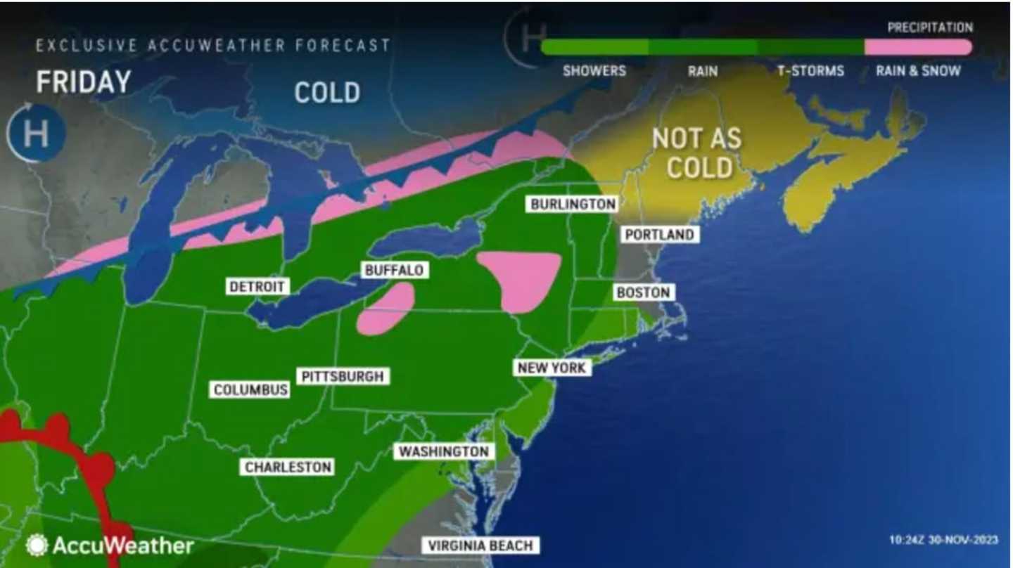
The arrival of the storm system on Friday will also usher in the start of a stretch of unsettled weather lasting into early next week marked by on-and-off rain and showers.
Friday is expected to be the rainiest day of that stretch, with precipitation moving in from west to east starting in the afternoon, with the heaviest rain expected at night.
Most areas will just see rain, although, in upstate New York and northern New England, some high terrain and northern areas will see a little wet snow mixed in at times, the National Weather Service said.
Friday's high temperature will be generally in the upper 40s.
Rain will wind down in the early morning hours of Saturday, Dec. 2, which will be a mostly cloudy day with a high temperature in the mid-40s.
"There also will be the potential for patchy fog soon after the rain begins that may linger into Saturday morning," according to AccuWeather.com.
The second storm system moving in from the south will bring a new round of precipitation on Sunday, Dec. 3 with the heaviest rain at night. The high temperature will be in the upper 40s to around 50 degrees.
Rain will linger through around noontime on Monday, Dec. 4 with a slight chance of showers in the afternoon and evening. It will be mostly cloudy with a high temperature again around 50 degrees.
Check back to Daily Voice for updates.
Click here to follow Daily Voice Brentwood and receive free news updates.