The warning starts at 6 a.m. on Monday, April 13 and lasts until 6 p.m. Monday.
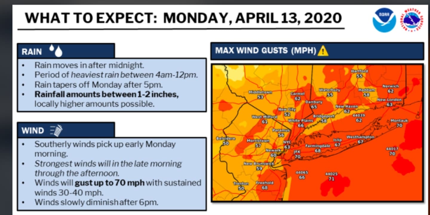
Sustained winds to 40 to 45 miles per hour and gusts up to 70 miles per hour could cause widespread power outages, the National Weather Service said.
The overnight low temperature will hold steady in the mid 50s as a surge of mild air arrives ahead of the storm system.
Rain is expected to start just before daybreak on Monday, with thunderstorm activity beginning around 9 a.m.
Even sturdy and well-secured tent structures could be damaged by wind gusts, the National Weather Service warns, noting widespread power outages are possible and travel could be difficult, especially for high profile vehicles.
Storms are expected to continue throughout the day with up to 2 inches of rainfall possible up through the early evening when rainfall transitions to showers before precipitation ends later Monday night.
In addition to the gusty winds, the storms will bring hail and flash flooding. An isolated tornado cannot be ruled out.
The system will push out late Monday night and it will become mostly clear overnight into Tuesday, April 14, which will be a mostly sunny day with a high temperature in the mid 50s.
Check back to Daily Voice for updates.
Click here to follow Daily Voice Nassau and receive free news updates.