
Here's what to expect -- and when:
Sunday, Jan. 14: Snow showers and snow squalls -- winter's equivalent of pop-up summer thunderstorms -- could reduce visibility at times on roadways and lead to a coating or so of accumulation, causing slippery driving conditions.
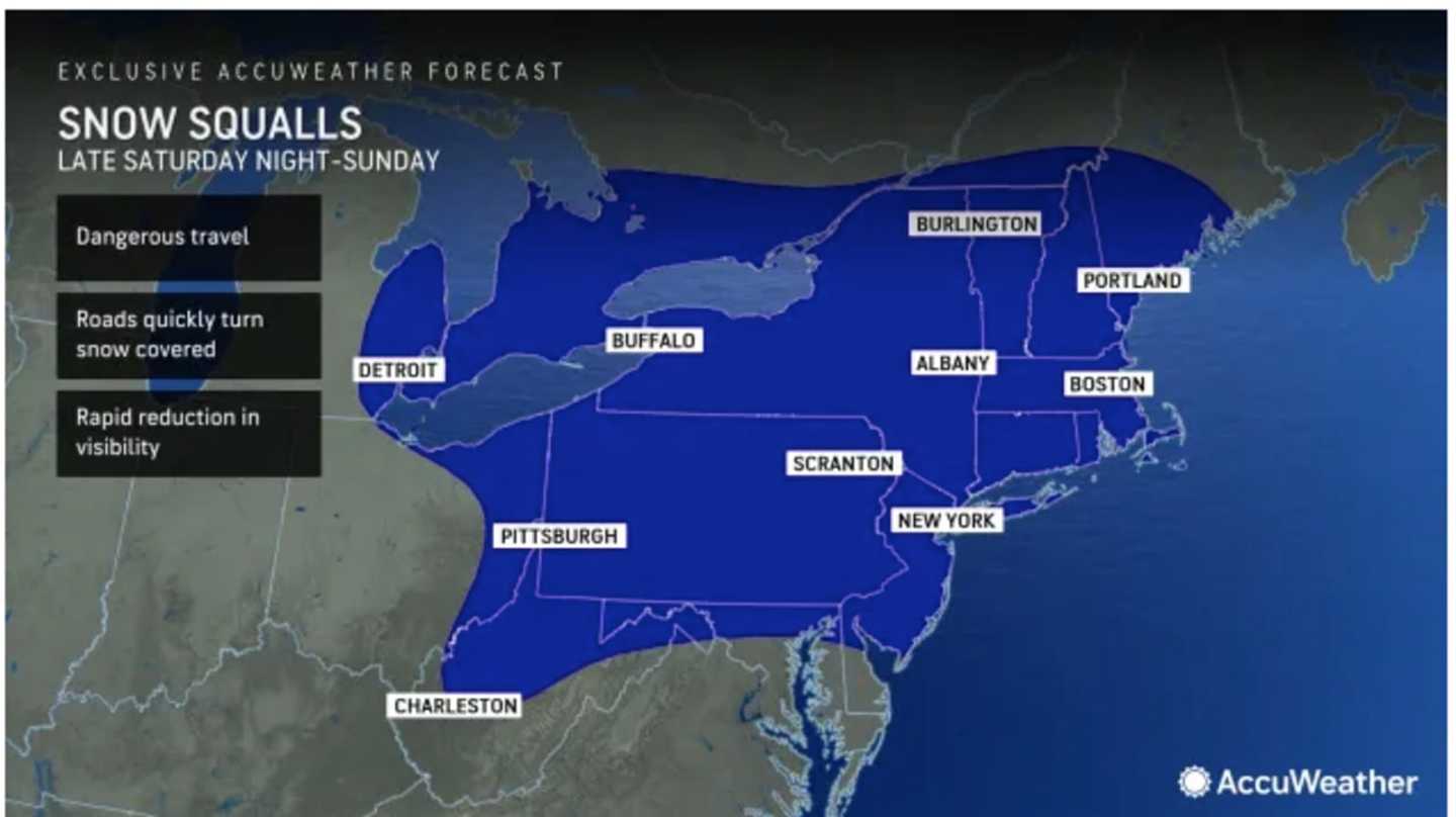
"There is a chance of snow showers today, with the potential for snow squalls, especially inland, which may quickly reduce visibilities and produce brief wind gusts near 45 mph," the National Weather Service said in a Hazardous Weather Outlook statement issued early Sunday morning. "Localized hazardous travel is possible in any snow squalls."
After a mainly sunny start, clouds will increase on Sunday, with the highest chance for snow showers and squalls in the early afternoon. (See the first image above from AccuWeather.com.) The high temperature will be in the mid to upper 30s with wind-chill values in the teens and 20s.
Tuesday, Jan. 16: A widespread 1 to 2 inches of snowfall is expected for a broad area in the Northeast shown in the light blue in the second image above. Other spots, especially those with higher elevations, could see around 3 inches.
Between 3 to 6 inches of snow is possible in several mid-Atantic states.
Current projections have the window for snowfall from late in the morning to the middle or late afternoon on Tuesday.
Friday, Jan. 19: A system on track to arrive during the day could linger into Friday evening with the potential for accumulating snow. There's currently uncertainty surrounding its potential path and strength.
In between the systems on Sunday and Tuesday, it will be mostly sunny and cold on Dr. Martin Luther King Jr. Day on Monday, Jan. 15 with the high temperature struggling to reach the freezing mark and not climbing out of the upper 20s in areas farthest north. Wind-chill values will be in the teens.
Wednesday, Jan. 17 and Thursday, Jan. 19 will be dry with a mix of sun and clouds both days and the high temperature around 30 degrees on Wednesday and 32 degrees on Thursday.
Check back to Daily Voice for updates.
Click here to follow Daily Voice Nassau and receive free news updates.