"It may be time to dust off your snow shovels as a flip in the weather pattern could send a snowstorm over parts of the Midwest and Northeast just days after a spell of unusual warmth," according to AccuWeather.com.
The system could start a "back to reality" shift to a weather pattern more typical of February.
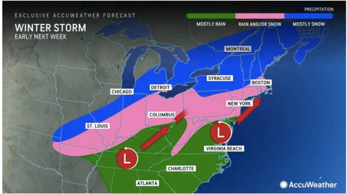
"While the January thaw and break from the stormy pattern extended into early February, there is going to be a change in the pattern with a potentially impactful storm coming swinging across the Midwest and Northeastern states from Monday to Tuesday," said AccuWeather Meteorologist Dean DeVore.
The mercury will reach the mid-40s throughout the region on Thursday, Feb. 8, and climb to around 50 degrees farther south with mostly sunny skies and calmer winds, according to the National Weather Service.
The stretch of sunny days that started in the first weekend of February following a month of January marked by cloudy skies will end overnight Thursday into Friday, Feb. 9.
It will be mostly cloudy on Friday with peeks of sun at times with the high temperatures reaching 50 degrees and into the low 50s in some spots.
Unseasonably mild temperatures will continue Saturday, Feb. 10, and Sunday, Feb. 11 with a mix of sun and clouds both days and a high temperature. in the mid-50s Saturday and around 50 degrees on Sunday.
Clouds will return overnight Sunday into Monday, Feb. 12 setting the stage for the potential new storm system.
It will be mostly cloudy on Monday with a high temperature in the 40s. Precipitation will become possible starting in the afternoon and continuing into the evening.
With the low temperature expected to drop to just below the freezing mark overnight into Tuesday morning, Feb. 13, there could be a mix of rain, sleet, and snow.
There's uncertainty surrounding the track and strength of the system, so it's too early to predict snowfall amounts.
After the quick-moving system moves through, temperatures will become more seasonable with highs in the 30s expected each day through the end of next week.
Check back to Daily Voice for updates.
Click here to follow Daily Voice Mount Pleasant and receive free news updates.