The time frame for the storm is Monday night, Feb. 12 into around midday on Tuesday, Feb. 13.
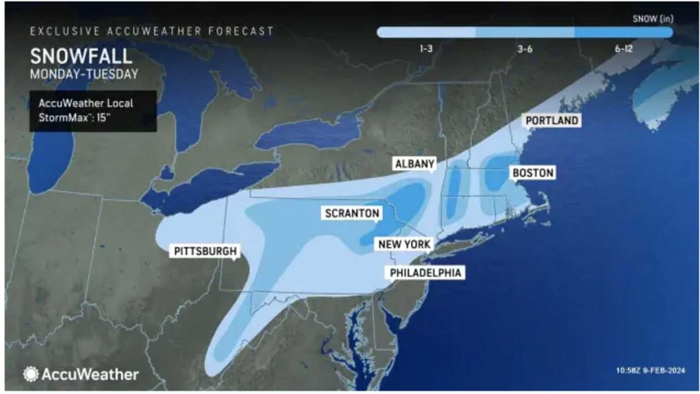
In the image above released on Friday, Feb. 9 by AccuWeather.com, areas with highest elevations in the darkest shade of blue are expected to see the most snowfall, with 6 inches to a foot of accumulation predicted.
Areas in Columbia blue are expected to see 3 to 6 inches of snowfall.
In spots shown in sky blue, 1 to 3 inches are forecast.
The days leading up to the storm's arrival will be anything but winterlike.
Unseasonably mild temperatures will continue Saturday, Feb. 10 with the possibility of maximum temps close to 20 degrees above normal, with a high temperature generally in the mid-50s with some areas farthest south possibly even hitting the 60-degree mark, according to the National Weather Service.
Sunday, Feb. 11's high will be around 50 degrees with a mix of sun and clouds before a cooling trend starts overnight as clouds thicken into Monday, setting the stage for the potential new storm system.
It will be mostly cloudy on Monday, with a high temperature in the 40s. Precipitation will become possible starting in the morning and then again at night.
With the low temperature expected to drop to just below the freezing mark overnight into Tuesday, a widespread mix of rain, sleet, and snow is expected from the system, with mainly snow in areas farther north and inland.
After the quick-moving system moves through by early afternoon Tuesday, temperatures will become more seasonable with highs in the 30s expected each day through the end of next week.
"One thing is for sure, this storm will start a pattern that brings colder, more active weather from the Midwest to the Northeast with reinforcing shots of seasonably cold air masses with the potential for some clipper systems to bring snow events," AccuWeather Meteorologist Dean DeVore said.
The current outlook for Valentine's Day on Wednesday, Feb. 14 calls for mostly sunny skies and a high temperature in the mid-30s.
Check back to Daily Voice for updates.
Click here to follow Daily Voice White Plains and receive free news updates.