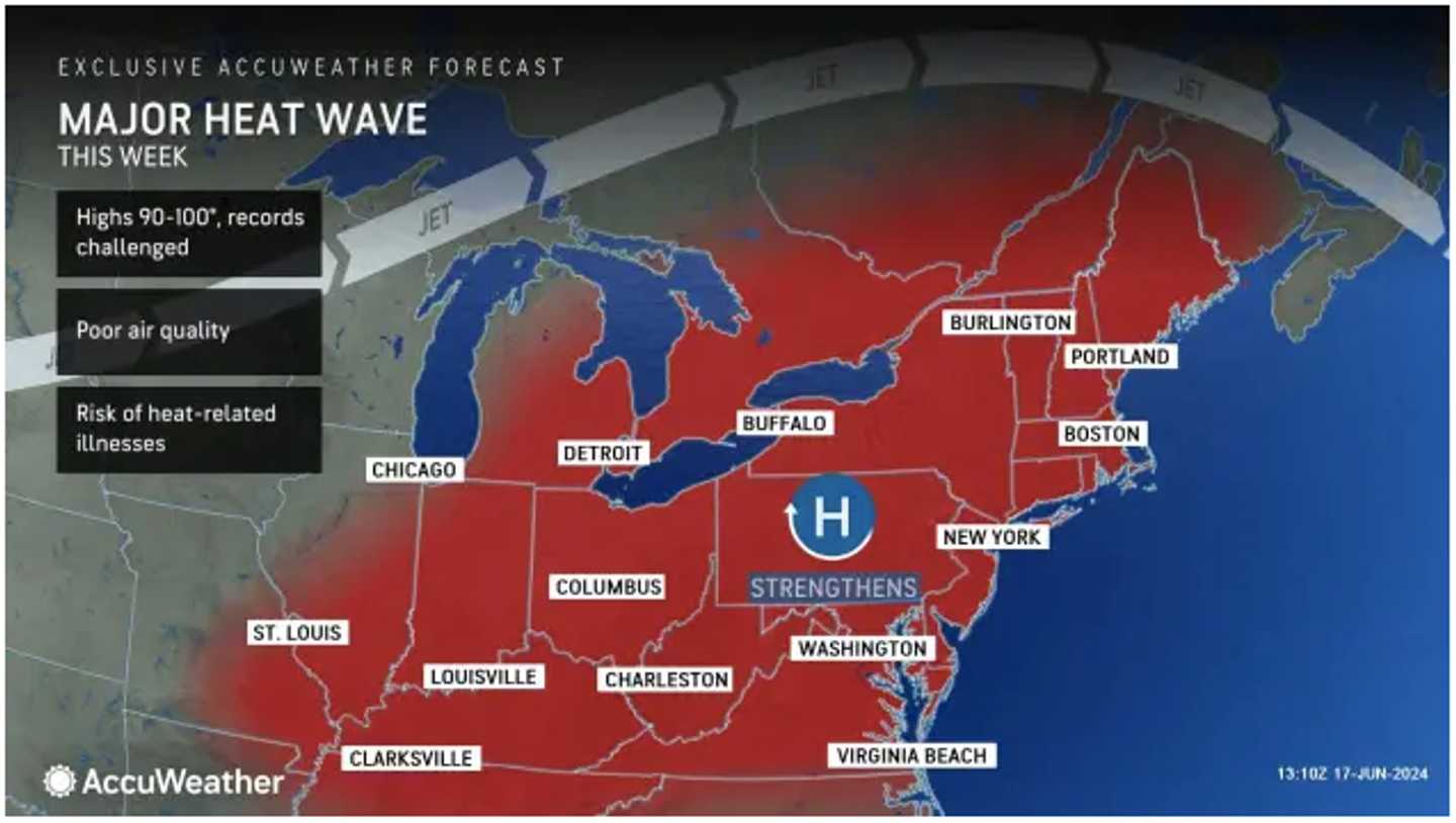
The extreme heat could affect about 135 million people across the US and parts of Canada from Tuesday, June 18 through Saturday, June 22, with dangerous conditions in store for a broad area.
"A large, sprawling area of high pressure will help to pump hot air into the East, and this pattern is expected to sustain itself into the upcoming weekend," said AccuWeather Senior Meteorologist Tyler Roys.
A heat wave is defined as three or more consecutive days in which the temperature is 90 degrees or higher.
According to the National Weather Service, the combination of heat and humidity will produce heat index values ranging between 95 and 105 degrees Fahrenheit from Tuesday until Saturday.
The high temperature will generally be in the low 80s, with some spots hitting the mid-80s.
Tuesday will be sunny, with a high temperature generally in the low 90s, before the highest heat indices of the week kick in the following few days.
The high temperature on Juneteenth, Wednesday, June 19, will again be in the low 90s, with sunny skies. Heat indices should be in the mid to upper 90s.
Thursday, June 20, marks the first day of summer. This year's solstice is at 4:51 p.m., and the temperatures will feel like it, with the high generally in the mid-90s.
The outlook for Friday, June 21 calls for mostly sunny skies with perhaps the warmest temps of the week, rising into the upper 90s. Showers and thunderstorms are possible from around the middle of the afternoon to the early evening.
Heat indices across the region Thursday and Friday will range from 95 to around 101 degrees, the National Weather Service says.
"The potential for heat-related illnesses is highest during the latter part of heat waves and even in the days following," says AccuWeather Senior Director of Forecasting Operations Dan DePodwin, "as the stress of consecutive days of hot weather takes time to build up in the body,"
The outlook for Saturday calls for partly sunny skies, a high temperature in the low 90s, and a chance of showers during the day and at night.
Check back to Daily Voice for updates.
Click here to follow Daily Voice The Berkshires and receive free news updates.