Find Your Daily Voice
 45°
45°
Here Comes Fred: Storm Will Bring Downpours, Localized Flooding, Isolated Tornadoes Possible
The remnants of Fred, which is now a Post-Tropical Cyclone, will bring locally heavy rainfall and localized flash flooding to the region, with isolated tornadoes possible.
The time frame for the main brunt of storm activity in the area will be Wednesday night, Aug. 18 into around noontime Thursday, Aug. 19.
For a look at the latest projected track and timing for Fred, see the first image above.
The highest chance for flooding will be to the north and west. (Click on the second image above.)
Generally, 1 to 2 inches of rainfall is now expected in this area, with locally high…
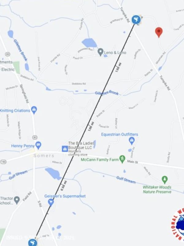
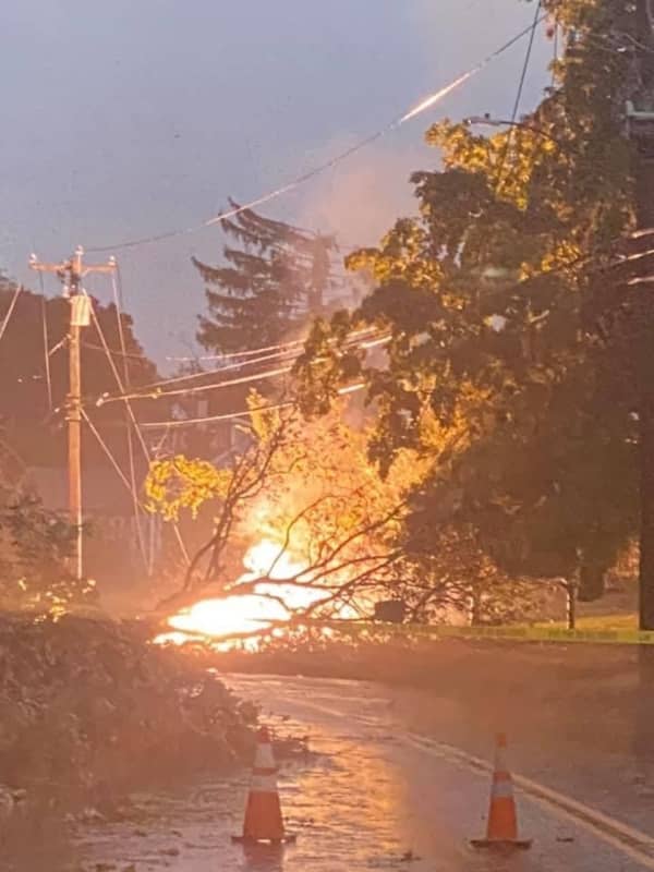
Tornado Confirmed In Northern CT, Bringing Down Trees, Destroying Vehicles
A tornado touched down in Connecticut during a severe thunderstorm leaving behind damaged trees, missing shingles, and two destroyed vehicles.
The tornado rated an EF-0 (the weakest of the five levels on the Enhanced Fujita Scale), touched between 6:11 p.m. and 6:18 p.m., Sunday, July 18, in the Town of Somers, located in Tolland County near the Massachusetts border, according to the National Weather Service.
The tornado was first reported by amateur radio operators on a tip from a trained Skywarn Weather Spotter, the service said.
The tornado, which traveled for about 1.9 miles, first tou…