One-Week Forecast

  1. Current
    Fair 63°
    • 84°
    • 64°
    Fair
  2. Wed 08/05
    Chance Thunderstorms
    • 84°
    • 71°
    Chance Thunderstorms
  3. Thu 08/06
    Rain Showers Likely
    • 86°
    • 71°
    Rain Showers Likely
  4. Fri 08/07
    Rain Showers Likely
    • 89°
    • 71°
    Rain Showers Likely
  5. Sat 08/08
    Chance Thunderstorms
    • 86°
    • 69°
    Chance Thunderstorms
  6. Sun 08/09
    Slight Chance Thunderstorms
    • 87°
    • 69°
    Slight Chance Thunderstorms
  7. Mon 08/10
    Mostly Sunny
    • 89°
    Mostly Sunny
Pennsylvania Air Gets Even Worse: Here's When Smoke Will Finally Clear Pennsylvania Air Gets Even Worse: Here's When Smoke Will Finally Clear
Pennsylvania Air Gets Even Worse: Here's When Smoke Will Finally Clear It's getting even harder to breathe across Pennsylvania as wildfire smoke from Canada continues to blanket the Commonwealth. The Pennsylvania Department of Environmental Protection upgraded Friday, July 17, to a statewide Code Purple Air Quality Action Day after smoke from Canadian wildfires intensified overnight. A Code Purple means air pollution has reached "Very Unhealthy" levels, and everyone is at increased risk of experiencing health effects. AirNow forecasts much of Pennsylvania will reach the "Very Unhealthy" category Friday. The worst conditions are expected in western and central …
More Than 145K Lose Power As New Storms Slam PA During Hot Holiday Weekend More Than 145K Lose Power As New Storms Slam PA During Hot Holiday Weekend
More Than 145K Lose Power As New Storms Slam PA During Hot Holiday Weekend Thousands of Pennsylvanians who spent the Independence Day weekend battling oppressive heat and repeated rounds of severe thunderstorms were plunged back into darkness, as another line of storms swept across the state. The latest storms brought heavy rain, damaging winds reaching 60 mph or higher, hail, and additional outages to communities where crews were already working to restore electricity from previous rounds of weekend weather. As of Monday morning, approximately 145,000 PPL Electric Utilities customers remained without power after more than 199,000 customers lost service during the…
6 Tornadoes Confirmed Across Western PA After Severe Storms (UPDATE) 6 Tornadoes Confirmed Across Western PA After Severe Storms (UPDATE)
6 Tornadoes Confirmed Across Western PA After Severe Storms (Update) Six tornadoes have now been confirmed across Western Pennsylvania following the severe thunderstorms that swept through the region on Saturday, June 6, according to a National Weather Service damage survey released Monday night. Meteorologists said all six tornadoes developed as rotating mesovortices embedded within a larger squall line. Additional areas of damage were caused by powerful straight-line winds. The strongest confirmed tornado was an EF1 that tracked more than seven miles across Washington County. According to the National Weather Service, the tornado formed near Cokeburg arou…
Snow Squalls, Sudden Whiteouts Threaten Travel Across Central PA: NWS Snow Squalls, Sudden Whiteouts Threaten Travel Across Central PA: NWS
Snow Squalls, Sudden Whiteouts Threaten Travel Across Central PA: NWS Dangerous snow squalls and fast-changing conditions are sweeping across Pennsylvania, forecasters warned on Tuesday, March 17. A Snow Squall Warning was issued for northwestern Clearfield County as a burst of heavy snow moved east at 40 mph, the National Weather Service in State College announced at 3:27 p.m. The squall was located over Reynoldsville around 3:26 p.m., bringing intense snowfall, wind gusts up to 35 mph, and visibility dropping below a quarter mile, according to the advisory. Travel could become “difficult and potentially dangerous within minutes,” especially along Interstat…
Meteor, Satellite Or Something Else? ‘Loud Boom,’ Fireball Reported Across Western PA: NWS Meteor, Satellite Or Something Else? ‘Loud Boom,’ Fireball Reported Across Western PA: NWS
Meteor, Satellite Or Something Else? ‘Loud Boom,’ Fireball Reported Across Western PA: NWS A loud boom and fiery streak across the morning sky startled residents across multiple states Tuesday, March 17, as federal weather officials pointed to a likely cause. The National Weather Service in Pittsburgh said it received numerous reports of a large fireball seen across parts of western Pennsylvania and eastern Ohio early Tuesday morning. Witnesses described a bright object streaking through the sky, followed by a “large boom” that was heard — and in some cases felt — across the region, according to the agency. Satellite imagery suggests the event was likely caused by a meteor enter…
21 Inches Of Snow Reported In PA Blizzard: Latest Totals 21 Inches Of Snow Reported In PA Blizzard: Latest Totals
21 Inches Of Snow Reported In PA Blizzard: Latest Totals A powerful winter storm has buried parts of Pennsylvania in more than 20 inches of snow as of Monday morning, Feb. 23, according to snowfall reports from the National Weather Service. The storm remains ongoing in some areas, and totals continue to climb, especially in eastern Pennsylvania. Western Pennsylvania Western PA saw lighter accumulations compared to the east. About 1 inch was reported in parts of the greater Pittsburgh area. Nearby communities such as Avonmore and Ford Cliff recorded around 2 inches. Somerset County reported just 1.2 inches in Callimont. Central Pennsylvania Sno…
2.4 Magnitude Earthquake Reported In Western NJ 2.4 Magnitude Earthquake Reported In Western NJ
2.4 Magnitude Earthquake Reported In Western NJ A small earthquake was recorded in New Jersey on Friday afternoon, Jan. 30, according to the U.S. Geological Survey. The USGS reported a magnitude 2.4 earthquake that struck approximately 6 kilometers north-northeast of Whitehouse Station at 3:42 p.m.  The quake occurred at a depth of about 8.9 kilometers, according to the agency. Residents in Glen Gardner, Califon, Bedminster, and Lebanon reported feeling it.
More Winter Weather Alerts Issued In NJ, PA As Tuesday Storm Aims At Morning Commute More Winter Weather Alerts Issued In NJ, PA As Tuesday Storm Aims At Morning Commute
More Winter Weather Alerts Issued In NJ, PA As Tuesday Storm Aims At Morning Commute Winter weather alerts have been issued across North Jersey and eastern Pennsylvania ahead of Tuesday’s storm, which is expected to bring several inches of snow and slippery roads during the morning commute, according to the National Weather Service. A Winter Storm Watch is in effect for Sussex County, where 4 to 7 inches of snow and snowfall rates of up to 1 inch per hour are possible. Winter Weather Advisories have been issued for Hunterdon, Morris, Warren, and Western Passaic counties, forecasters said. In Pennsylvania, winter weather advisories cover Berks, Lehigh, Northampton, Upper Bu…
Tornado Confirmed In Central PA, Baseball Dugout, Crops Damaged: NWS Tornado Confirmed In Central PA, Baseball Dugout, Crops Damaged: NWS
Tornado Confirmed In Central PA, Baseball Dugout, Crops Damaged: NWS A brief tornado touched down in Quarryville during storms late Thursday, Sept. 4, the National Weather Service in State College confirmed on Sunday, Sept. 7. The EF-0 tornado produced peak winds of 70 mph, had a path length of 0.15 miles, and reached a maximum width of 30 yards, officials said. It spun up southeast of Collins at 9:31 p.m. and lifted the roof off a dugout at the Solanco Youth Baseball Association, according to the release. The tornado then crossed Kirkwood Pike and damaged crops in a field just north of Encounter Church before lifting near a wooded residential area northwes…
State Of Emergency: Hurricane Erin Batters NJ Shore With 14-Foot Waves, Peak Flooding Tonight State Of Emergency: Hurricane Erin Batters NJ Shore With 14-Foot Waves, Peak Flooding Tonight
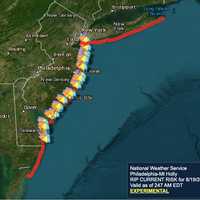
State Of Emergency: Hurricane Erin Batters NJ Shore With 14-Foot Waves, Peak Flooding Tonight New Jersey Gov. Phil Murphy has declared a State of Emergency ahead of Hurricane Erin, warning residents about dangerous conditions along the Shore Thursday, Aug. 21. The State of Emergency went into effect at 2 p.m. "in preparation for Hurricane Erin,” Murphy said. “Life-threatening rip currents will be present at all ocean beaches across the state. Absolutely no one should be in the water today or tomorrow.” As of 2 p.m., Hurricane Erin was moving farther away from the Mid-Atlantic coast, according to the National Weather Service in Mount Holly. Wind gusts of 35 to 45 mph were reported al…
Swimming Banned At These NJ Beaches As Hurricane Erin Approaches Swimming Banned At These NJ Beaches As Hurricane Erin Approaches
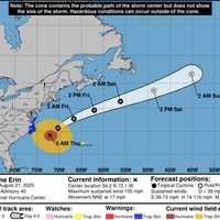
Swimming Banned At These NJ Beaches As Hurricane Erin Approaches Hurricane Erin is churning up the Atlantic, prompting dangerous surf conditions and widespread swimming restrictions at New Jersey beaches this week. Hurricane Erin's projected path. National Weather Service The National Weather Service said Tuesday, Aug. 19, that breaking waves will significantly increase along the Jersey Shore through Thursday, with life-threatening rip currents and swells of 6 to 11 feet expected.  “Life threatening rip currents are likely. The surf zone is dangerous for all levels of swimmers. Stay out of the water,” the agency warned. A High Rip Current R…
Small Tornado Touches Down Near US Naval Academy During Storms: Weather Service Small Tornado Touches Down Near US Naval Academy During Storms: Weather Service
Small Tornado Touches Down Near US Naval Academy During Storms: Weather Service The National Weather Service confirmed that a small tornado was spotted in Maryland during the peak of Thursday's storms.  Forecasters say that a waterspout formed over Spa Creek — near the US Naval Academy — and what registered as an EF-0 tornado briefly touched down in Eastport on July 31. According to the National Weather Service, the tornado was reported shortly after 2:45 p.m. on Thursday with peak winds estimated at 65 mph. Its path was just 0.1 miles long, and it had a max width of 25 yards. A combination of videos and photographic evidence have confirmed that a waterspout b…
Allentown Faces Flash Flood Watch As Storms Hit PA Monday Night Allentown Faces Flash Flood Watch As Storms Hit PA Monday Night
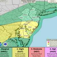
Allentown Faces Flash Flood Watch As Storms Hit PA Monday Night A powerful round of thunderstorms is expected to hit New Jersey and eastern Pennsylvania beginning Monday afternoon, July 14, with the National Weather Service warning of flash flooding, possible power outages, and dangerous driving conditions. The NWS in Mount Holly issued a Flood Watch that remains in effect through 2 a.m. Tuesday for large parts of the region. Some areas could see rainfall rates exceeding two inches per hour, with total accumulation of up to five inches in spots. Another round of storms is likely Tuesday afternoon, adding to the risk. According to forecasters, the greate…
Tornado Touched Down In Pennsylvania: NWS Survey Confirms Tornado Touched Down In Pennsylvania: NWS Survey Confirms
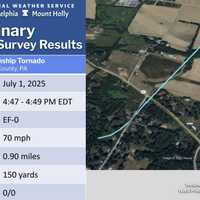
Tornado Touched Down In Pennsylvania: NWS Survey Confirms A weak tornado briefly touched down in Berks County, damaging trees along a nearly mile-long path, the National Weather Service confirmed in a statement issued Wednesday, July 2. The EF-0 twister struck Weavertown in Amity Township around 4:47 p.m. on Tuesday, July 1, according to the NWS Mount Holly office. Peak winds were estimated at 70 mph. "Several trees had large limbs broken or snapped off, some of which were twisted," the agency wrote. One tree was completely uprooted, and tree damage continued along Weavertown Lane, crossing Old Swede Road. The tornado’s path ended at Boyertown Pik…
28K+ Without Power As Extreme Heat Wave Scorches Pennsylvania 28K+ Without Power As Extreme Heat Wave Scorches Pennsylvania
28K+ Without Power As Extreme Heat Wave Scorches Pennsylvania Blistering temperatures and busted substations are pushing Pennsylvania's electric grid to the brink. Over 28,000 customers across the state were left in the dark Monday, June 23, as oppressive heat surged into the region, compounding recovery efforts from Thursday night's severe storms, utility companies said. Littlestown Blackout: Substation Failure Leaves 65% Without Power In Adams County, more than 2,500 First Energy customers are without power after a “major equipment failure” at a Met-Ed substation, according to a statement from Adams Electric Cooperative, Inc. That failure also disru…
Tornado, Flood, Hail Threat As ‘Extreme Thunderstorms’ Slam Region Tornado, Flood, Hail Threat As ‘Extreme Thunderstorms’ Slam Region
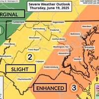
Tornado, Flood, Hail Threat As ‘Extreme Thunderstorms’ Slam Region Wild winds, large hail, floods, and possible tornadoes may roll through the region overnight, forecasters are warning. The National Weather Service issued a "Level 3 High Impact Severe Weather Threat" on Thursday, June 19, as storms begin hitting the area. 12:24pm CDT #SPC_MD 1364 , #njwx #pawx #dewx #mdwx #vawx #dcwx #wvwx, https://t.co/Y7ej7h7rco pic.twitter.com/q6cAaizrQk — NWS Storm Prediction Center (@NWSSPC) June 19, 2025 Officials also issued severe thunderstorm and flood warnings for parts of Virginia and western Maryland. "Severe Thunderstorm Watch in effect for a large porti…
Heat Advisory Issued In NJ/PA: Here’s Where Temps Will Feel Like 100° Heat Advisory Issued In NJ/PA: Here’s Where Temps Will Feel Like 100°
Heat Advisory Issued In NJ/PA: Here’s Where Temps Will Feel Like 100° The National Weather Service has issued a Heat Advisory for parts of New Jersey and Pennsylvania, with “heat index values up to 99 expected” and the potential for it to feel even hotter in the sun. The advisory is in effect from 11 a.m. Wednesday, June 18, through 8 p.m. Thursday, June 19, as dangerously high temperatures and humidity grip the region. ⚠️ Heat Advisory Areas Include: Camden County Gloucester County Northwestern Burlington County Philadelphia County Delaware County “Hot temperatures and high humidity may cause heat illnesses,” officials said in the advisory issued at 2:22 a…
Tornado And Earthquake Rock Pennsylvania Days Apart; Here's Where Tornado And Earthquake Rock Pennsylvania Days Apart; Here's Where
Tornado And Earthquake Rock Pennsylvania Days Apart; Here's Where A twister and a tremor shook separate corners of Pennsylvania just days apart, officials say. Surveyors with the National Weather Service confirmed an EF-0 tornado touched down in Clarion County on Tuesday, June 4, bringing 75 mph winds and damaging storms. The tornado carved its path along Brush Run Road, though officials say the exact track has not yet been determined. Crews also examined nearby damage along Haugh Hollow Road and Route 322, but determined that was caused by a downburst or straight-line winds peaking at 80 mph — not tornadic activity. This marks the first confirmed tornad…
Winds Up To 70 MPH, Hail, Lightning Expected In NJ, PA: Here's The Timing Winds Up To 70 MPH, Hail, Lightning Expected In NJ, PA: Here's The Timing
Winds Up To 70 MPH, Hail, Lightning Expected In NJ, PA: Here's The Timing Flash flooding is slamming parts of New Jersey and southeastern Pennsylvania Friday, May 16, with more severe weather possible on Saturday, forecasters say. At 11:32 a.m., the National Weather Service in Mount Holly issued a Flash Flood Warning after Doppler radar showed rainfall rates of 2 to 4 inches per hour. Some areas have already recorded an inch of rain. “Flash flooding caused by thunderstorms,” the NWS said. “Flash flooding is ongoing or expected to begin shortly.” The warning is in effect until 3:30 p.m. for the following counties: In New Jersey: Southwestern Mercer, Northwester…
Videos Show Tornado Confirmed In PA, National Weather Service Says Videos Show Tornado Confirmed In PA, National Weather Service Says
Videos Show Tornado Confirmed In PA, National Weather Service Says A tornado touched down near Bangor in Northampton County on Tuesday afternoon, May 6, the National Weather Service in Mount Holly confirmed. “We have confirmed a tornado occurred this afternoon near Bangor in Northampton County, PA,” the agency said. “Additional details will follow later this week after a storm damage assessment is completed.” Multiple videos of the twister surfaced before it was confirmed. LIKELY TORNADO ON THE GROUND…Moving towards Bangor, PA. Shot from Bushkill Township, PA. #PAwx @NWS_MountHolly pic.twitter.com/mr1MVtBYAA — joseph martucci (@jtooch07) May 6, 2025 …
Ping Pong-Sized Hail, 70 MPH Winds Threaten North Jersey, Lehigh Valley Ping Pong-Sized Hail, 70 MPH Winds Threaten North Jersey, Lehigh Valley
Ping Pong-Sized Hail, 70 MPH Winds Threaten North Jersey, Lehigh Valley A Severe Thunderstorm Watch is in effect until 8 p.m. Tuesday, May 6, for parts of New Jersey and Pennsylvania, the National Weather Service Storm Prediction Center said. Residents in Philadelphia, Trenton, Allentown, Reading, and across North and Central Jersey are impacted, the NWS said. “Isolated thunderstorms have developed over portions of the region,” the National Weather Service said in a Tuesday afternoon update. “The primary threat will be for hail and damaging winds across eastern PA and northern/central NJ.” Threats include: Scattered hail up to ping-pong ball size Wind gusts …
Possible Tornados, High Winds, Severe Storms Threaten Pennsylvania Possible Tornados, High Winds, Severe Storms Threaten Pennsylvania
Possible Tornados, High Winds, Severe Storms Threaten Pennsylvania A powerful storm system moving through the East Coast is expected to bring severe thunderstorms, strong winds, and the possibility of isolated tornadoes to parts of New Jersey and Pennsylvania late Sunday, March 16, into the evening, forecasters say. According to the National Weather Service (NWS) and AccuWeather, the storm poses several risks, including: Damaging wind gusts between 55-65 mph, with isolated gusts up to 90 mph possible. Heavy rain leading to flash flooding in low-lying areas. Possible isolated tornadoes, particularly in eastern Pennsylvania and the Delmarva region. "Widespr…
Tornado Watch Issued For Parts Of Pennsylvnia As Severe Storms Loom Tornado Watch Issued For Parts Of Pennsylvnia As Severe Storms Loom
Tornado Watch Issued For Parts Of Pennsylvnia As Severe Storms Loom A tornado watch has been issued in parts of Maryland, Virginia, and Pennsylvania as a storm is expected to roll through the area on Sunday. The National Weather Service issued alerts on March 16 as meteorologists prepare for another round of storms that could cause chaos in the DMV region. According to officials, a couple of tornadoes are possible, as well as hail the size of a quarter and winds approaching 70 mph in parts of the area. A tornado watch has been issued for parts of Maryland, Pennsylvania, Virginia and West Virginia until 7 PM EDT pic.twitter.com/TdXF7vQl8S — NWS Tornado (…
Is The Nice Weather Here To Stay In PA? Here's What Forecasters Say Is The Nice Weather Here To Stay In PA? Here's What Forecasters Say
Is The Nice Weather Here To Stay In PA? Here's What Forecasters Say The stretch of unseasonably warm temperatures has many wondering: is spring coming early, or will winter make a comeback?  The answer: A little bit of both. Tuesday, March 11, will bring the warmest day of the week, with temperatures near 70 degrees in both New Jersey and the Philadelphia area, according to the National Weather Service. Sunshine and light winds will make for perfect outdoor conditions, but don’t get too comfortable—a midweek cooldown is on the way. “Today will be the first of several days ahead of above-normal temperatures, with highs well into the 60s in most areas,”…
50+ MPH Winds, Thunderstorms To Slam NJ, PA: Here’s When It Hits 50+ MPH Winds, Thunderstorms To Slam NJ, PA: Here’s When It Hits
50+ MPH Winds, Thunderstorms To Slam NJ, PA: Here’s When It Hits A strong storm system will sweep across New Jersey and Pennsylvania on Wednesday, March 5, delivering damaging winds, torrential rain, and possible severe thunderstorms, according to the National Weather Service (NWS) Mount Holly. Wind gusts between 45 and 50 mph are expected across much of the region, with higher gusts nearing 60 mph possible along the Jersey Shore and Delmarva Peninsula, forecasters said. “The heavily populated I-95 corridor will finally experience the gusty winds on the final day of this multi-day episode on Wednesday, as the storm intensifies and moves into Canada,” Acc…
60 MPH Winds, Heavy Rain Will Batter PA: Outages, Flooding Possible 60 MPH Winds, Heavy Rain Will Batter PA: Outages, Flooding Possible
60 MPH Winds, Heavy Rain Will Batter PA: Outages, Flooding Possible A powerful storm system is sweeping across New Jersey on Sunday, Feb. 16, bringing damaging winds, heavy rain, and the potential for flooding and power outages, according to the National Weather Service (NWS). The strongest winds are expected to peak in the afternoon into the evening, with gusts between 50 and 60 mph hitting many areas across the state. The hardest-hit areas for wind gusts include Morristown, Flemington, and Trenton, where winds are forecasted to reach 50 to 60 mph through tonight. Similar gusts are expected in greater Philadelphia, the Lehigh Valley, Vineland, and Atlantic …
Foot Of Snow Could Wallop Parts Of PA, Winter Storm Warning In Effect Foot Of Snow Could Wallop Parts Of PA, Winter Storm Warning In Effect
Foot Of Snow Could Wallop Parts Of PA, Winter Storm Warning In Effect New Jersey Gov. Phil Murphy declared a State of Emergency beginning Sunday morning, Jan. 19, right as the National Weather Service released a brand-new snowfall forecast for the winter storm heading toward the region. CLICK HERE FOR LATEST FORECAST AS OF 9 AM JAN. 19, 2025. The storm will begin with scattered showers and a low of 26 degrees Saturday night, Jan. 18, the NWS said. By Sunday afternoon, snow is expected to begin after 1 p.m., with temperatures hovering around 30 degrees. The snow could be heavy at times, with rates exceeding 1 inch per hour, especially in areas northwest of the…
Arctic Blast Will Follow Snow Showers Across PA With Temps We Haven't Seen In Years, NWS Says Arctic Blast Will Follow Snow Showers Across PA With Temps We Haven't Seen In Years, NWS Says
Arctic Blast Will Follow Snow Showers Across PA With Temps We Haven't Seen In Years, NWS Says Light snow showers are forecast to begin Thursday afternoon, Jan. 16 across parts of New Jersey and Pennsylvania, potentially creating slippery conditions during the evening commute, according to the National Weather Service (NWS).  A Hazardous Weather Outlook has been issued for several northeast New Jersey counties, including Passaic, Hudson, Bergen, Essex, and Union, with snowfall set to begin after 4 p.m. Most areas are expected to see less than one inch of snow, though localized accumulations of up to two inches are possible in parts of eastern Pennsylvania near and north of …
6 To 8 Inches Of Snow Could Fall In Parts Of NJ, PA: Here's The Latest Winter Storm Forecast 6 To 8 Inches Of Snow Could Fall In Parts Of NJ, PA: Here's The Latest Winter Storm Forecast
6 To 8 Inches Of Snow Could Fall In Parts Of NJ, PA: Here's The Latest Winter Storm Forecast The first significant snowstorm of 2025 is expected to hit the region Sunday night, Jan 5, bringing up to 8 inches of snow to parts of New Jersey and Pennsylvania, according to the National Weather Service. The storm is expected to begin late Sunday night, continuing through Monday, Jan. 6 before tapering off into Monday night.  Snow accumulations are forecast across the region, with the highest totals predicted in South Jersey (Vineland, Atlantic City, Cape May) and Philadelphia, where snowfall could reach 6 to 8 inches, new weather maps show.  Greater Philadelphia could see 3 t…
Freezing Rain To Glaze Lehigh County Roadways With Ice, NWS Says: Here's The Timing Freezing Rain To Glaze Lehigh County Roadways With Ice, NWS Says: Here's The Timing
Freezing Rain To Glaze Lehigh County Roadways With Ice, NWS Says: Here's The Timing A Winter Weather Advisory has been issued for parts of New Jersey and Pennsylvania as freezing rain is expected to create icy road conditions Friday night, Dec. 27 into Saturday morning, Dec. 28, according to the National Weather Service (NWS). The advisory is in effect from 7 p.m. Friday to Saturday. Ice accumulations of up to one-tenth of an inch are anticipated in Sussex, Warren, and Morris counties, in NJ, and Lehigh and Northampton counties, in PA. "Very slippery sidewalks, roads, and bridges are possible," the NWS warned. Motorists are urged to slow down and exercise caution while dri…
1 To 3 Inches Of Snow Expected This Weekend In Parts Of NJ, PA: Here's Your Forecast 1 To 3 Inches Of Snow Expected This Weekend In Parts Of NJ, PA: Here's Your Forecast
1 To 3 Inches Of Snow Expected This Weekend In Parts Of NJ, PA: Here's Your Forecast A weak winter system is expected to bring a mix of light snow and rain to parts of New Jersey and Pennsylvania beginning Friday morning, Dec. 20, and lasting into early Saturday, Dec. 21, the National Weather Service (NWS) in Mount Holly said. A weak system will move through Friday into early Saturday morning, bringing a mixed bag of wintry weather across the... Posted by US National Weather Service Philadelphia/Mount Holly on Thursday, December 19, 2024 The Poconos and northwest New Jersey are expected to see the most snow, with accumulations ranging from 1 to 3 inches. Areas north…