
And it's no April Fools' joke.
That's because an unsettled that will arrive right after Easter Sunday, March 31 will continue into midweek, capped off by a chance of snowfall when a coast-to-coast storm arrives in the Northeast.
Clouds will thicken as the calendar flips to a new month on Monday, April 1, marking the beginning of a days-long stormy period.
Rain is likely both during the day and again at night on Monday as the high temperature will range from the upper 40s to around 50 degrees.
A widespread half-inch or more of rainfall is expected.
There will be rain throughout the day Tuesday, April 2, and Wednesday, April 3 with a high temperature in the mid-40s both days.
About 1.5 inches of precipitation is projected for Tuesday, which will be blustery with wind speeds in the teens and gusts up to 20 to 25 miles per hour.
Approximately a half-inch of rain is predicted for Wednesday, with locally higher amounts as the midweek storm moves eastward.
"A storm making a cross-country trek over the coming days will bring along a flurry of impactful weather from coast-to-coast, including the risk for an all-out winter storm mid- to late this week," according to AccuWeather.
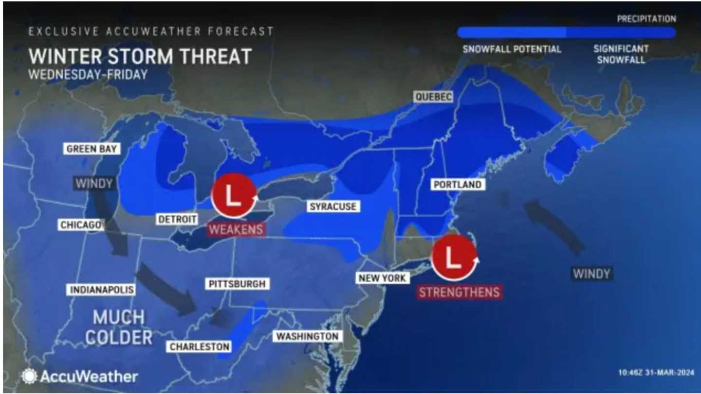
Snow is expected Wednesday night, April 3 into Thursday, April 4 in a wide part of the Northeast displayed in blue in the first image above with significant snowfall possible in areas shown in dark blue.
It's too early to predict potential snowfall amounts for those inland areas.
Check back to Daily Voice for updates.
Click here to follow Daily Voice Brentwood and receive free news updates.