
Steady rainfall starting Tuesday afternoon, April 2 will continue overnight into Wednesday, April 3, according to the National Weather Service.
The height of the storm will be Wednesday night into Thursday, April 4, with up to 2 inches of rainfall for most of the region, and snow farther north. (See the first image above from AccuWeather.com.)
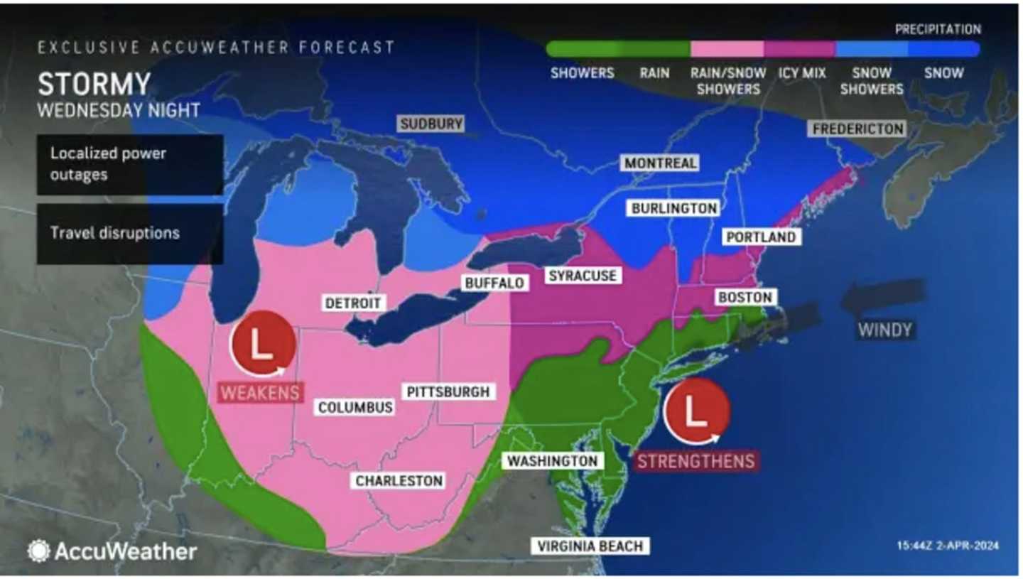
Thunderstorms are possible starting around nightfall on Wednesday, and wind gusts could hit 40 mph in spots.
Wednesday will be a bit cooler with highs generally in the low 40s.
Snow is expected Wednesday night into Thursday in a wide part of the Northeast displayed in blue in the second image above from AccuWeather.com with significant snowfall possible in areas shown in dark blue.
Areas in upstate New York and northern New England, the darkest shade of blue could see between 12 and 24 inches of snowfall, with snowfall rates of 2 inches per hour expected at times, possibly making it one of the strongest storms of 2023-24 -- albeit not even in the winter.
About 6 to 12 inches of accumulation is possible in much of New England, including Western Massachusetts, and upstate New York, with a widespread 1 to 6 inches in other areas shown in the two lightest shades of blue.
Areas farther south -- generally south of the I-84 corridor -- will see a mix of rain, sleet, and snow, with little or no accumulation, with mainly rain along the coast.
Precipitation is now expected to wind down as rain for most of the Northeast from west to east beginning shortly after daybreak Thursday morning.
It will be mostly cloudy throughout Thursday with showers and a high temperature climbing into the mid-40s.
The outlook for Friday, April 5 calls for partly sunny skies with a high in the upper 40s.
Check back to Daily Voice for updates.
Click here to follow Daily Voice Tarrytown-SleepyHollow and receive free news updates.