NOAA's National Weather Service forecasters are predicting cooler-than-average and wetter-than-average conditions in parts of the North with La Niña conditions once again predicted to shape part of the overall weather patterns this winter.
For precipitation predictions for the upcoming season, see the first image above.
Click here to see the complete NOAA winter outlook report.
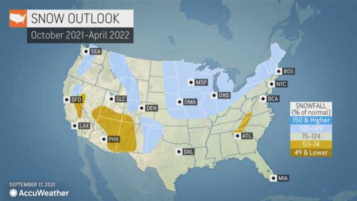
For a video look at NOAA's winter outlook, click here.AccuWeather’s team of long-range forecasters earlier released its annual prediction for the winter season.
The first waves of winter are expected in the Northeast in November when AccuWeather Senior Meteorologist Paul Pastelok said there could be “a couple of rounds of cold weather and some snow."
The chance of plowable snow is also predicted to start early in the season with that cold air.
Areas closer to the coast could also get the chance of early-season cold and snow, but it is not predicted to be as cold or as snowy as across areas farther inland.
The severity and frequency of the snow and cold air are likely to let up a bit by mid-December before returning in January.
“That’s the month that stands out,” Pastelok said.
In fact, the traditional "January thaw," in which the cold air lets up a bit may not come until February.
In addition, the polar vortex could make its presence felt late in the season.
“At the end of the winter into early spring, there could be another attempt of the polar vortex being displaced or split,” Pastelok said.
That would result in frigid Arctic air across the Northeast, extending the wintry weather well past March 1, which marks the beginning of meteorological spring.
Check back to Daily Voice for updates.
Click here to follow Daily Voice Tarrytown-SleepyHollow and receive free news updates.


