
In just a few days amid an unsettled weather pattern and drop in temperatures, a new system has the potential to bring accumulating snowfall and ice to the Northeast.
The storm is expected to arrive in the region Tuesday morning, Jan. 16, the National Weather Service says.
"The storm is expected to ride the jet stream and along the fringe of a press of Arctic air that will expand across most of the nation into midmonth and beyond," according to AccuWeather Meteorologist Brandon Buckingham.
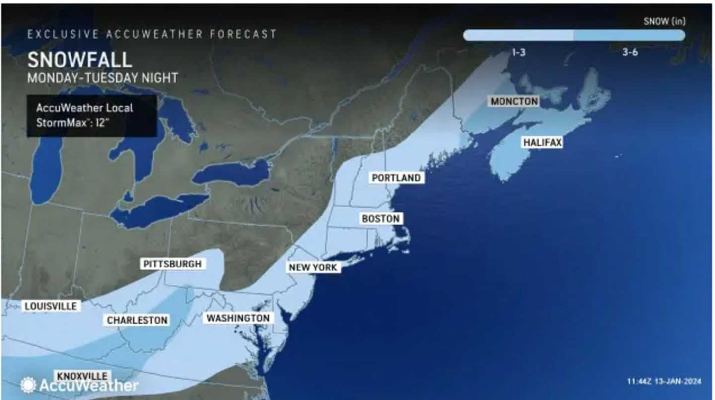
The first projections are calling for a widespread 1 to 3 inches of snowfall. (See the first image above.)
It will be breezy on Saturday with winds out of the south with speeds as high as 20 miles per hour and gusts around 30 mph as the storm that arrived overnight pushes off the coast. (Click on the second image above for a radar image of the region from early Saturday morning.)
Minor flooding is expected to continue in the most vulnerable locations near the waterfront and shoreline, including riverfront communities, through the middle of Saturday afternoon.
Skies will gradually become mostly clear Saturday night before clouds return on Sunday, Jan. 14 after a partly sunny start.
Sunday's high temperature will generally be in the upper 30s with clouds increasing in the afternoon before a chance of scattered showers and snow showers later in the afternoon as the temperature falls.
It will be mostly sunny and cold on Dr. Martin Luther King Jr. Day on Monday, Jan. 15 with the high temperature struggling to reach the freezing mark.
The lower temperatures will set the stage for the likelihood of accumulating snow on Tuesday as the quick-moving winter storm sweeps through.
With a high temperature right around the freezing mark, snow will mix with rain at times, causing icy and slick conditions.
Snowfall is expected to wind down by Tuesday night.
There's still uncertainty surrounding the storm's track and potential strength, and snowfall projections could increase.
Skies will clear Wednesday morning, Jan. 17 on a mostly sunny and cold day with a high temperature in the upper 20s.
Check back to Daily Voice for updates.
Click here to follow Daily Voice Suffolk and receive free news updates.