

A new tropical storm could become a major hurricane this weekend and make landfall in the United States.
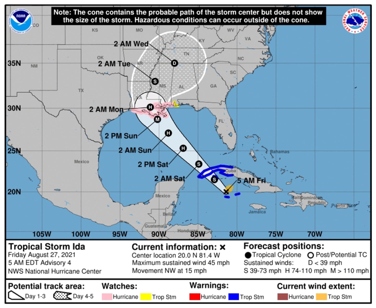
Tropical Storm Ida, the ninth-named storm of the 2021 Atlantic season, is expected to intensify Saturday, Aug. 28 into Sunday, Aug. 29, with projected winds of 100 miles per hour or more just south of the mouth of the Mississippi River, which would make it a Category 3 or Cat 4 hurricane.
Landfall is projected to be Sunday afternoon or evening just west of New Orleans, putting New Orleans on the dangerous right side of the storm. Sunday marks the 16th anniversary of Hurricane Katrina, which devastated New Orleans and much of the Gulf Coast.
As of Friday morning, Aug. 27, it's located northwest of Grand Cayman Island with maximum sustained winds of 45 mph.
Life-threatening storm surges of 7 to 11 feet are expected, along with widespread rainfall of 8 to 16 inches, with isolated amounts of as high as 20 inches of rain, according to the National Hurricane Center, which says potential impacts of the storm could be "devastating to catastrophic," and include:
- Structural damage to sturdy buildings, some with complete roof and wall failures.
- Complete destruction of mobile homes.
- Damage greatly accentuated by large airborne projectiles.
- Locations may be uninhabitable for weeks or months.
- Numerous large trees snapped or uprooted along with fences and roadway signs blown over.
- Many roads impassable from large debris, and more within urban or heavily wooded places. Many bridges, causeways, and access routes impassable.
- Widespread power and communications outages.
The National Hurricane Center has issued hurricane and storm surge watches for portions of Alabama, Louisiana, and Mississippi.
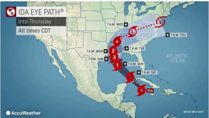
For the latest projected path for Tropical Storm Ida, released Friday morning, Aug. 27, click on the first and second images above.
The latest projected Tropical-Storm-Force winds for Ida can be viewed by clicking on the third image above.
Check back to Daily Voice for updates.
Click here to follow Daily Voice North Rockland and receive free news updates.