A widespread 1 to 1 1/2 inches of rainfall is expected, with locally higher amounts of around 2 inches, the National Weather Service said in a Hazardous Weather Outlook statement issued early Tuesday morning, Dec. 26.
"With streamflows and soil moisture still running high, there is potential for minor flood stages to be reached along a few to several quick responding streams in this area if the high end of rainfall forecast is reached."
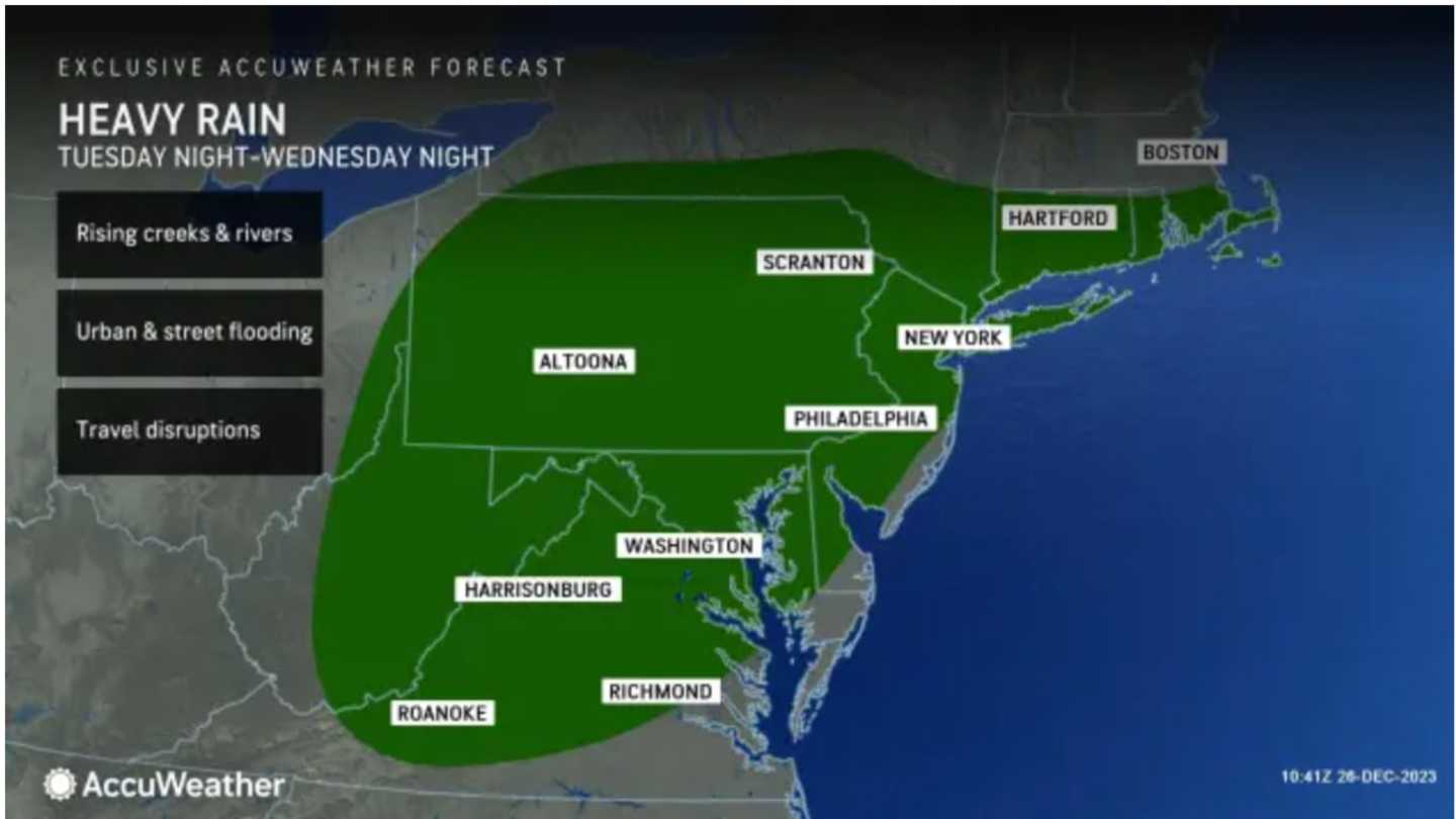
The highest amounts of rainfall and biggest threats for flooding are in areas of the Northeast farther south. (See the image above from AccuWeather.com)
After scattered showers and rain through Wednesday morning, Dec. 27, the rainfall will pick up in intensity in the afternoon and evening. The daytime temperature will hold steady at around 50 degrees.
After scattered showers and rainfall through Wednesday morning, the rainfall will pick up in intensity in the afternoon and evening. The daytime temperature will hold steady at around 50 degrees.
Thursday, Dec. 28 will be mostly cloudy and mild with a high temperature reaching the low 50s in some spots and a chance for spotty showers.
There will be more scattered showers on Friday, Dec. 29 which will be a cooler day with high temperatures in the low 40s.
Saturday, Dec. 30 will be mostly sunny with peeks of sun and a high temperature generally in the low 40s. A scattered shower can't be ruled out.
Check back to Daily Voice for updates.
Click here to follow Daily Voice Massapequa and receive free news updates.