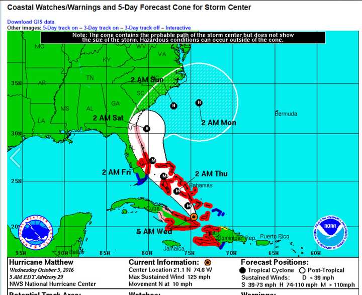
But new longterm models for the storm's path released Wednesday morning come as good news for this area as the projected track for Matthew is now trending south, greatly reducing its potential impact in the Hudson Valley, according to the National Weather Service.
In fact, the rain possible for the area Saturday and Sunday would likely come from a cold front instead of as a result of Matthew's movement.
A Category 3 hurricane with sustained winds around 115 miles per hour, Matthew, which is responsible for 11 deaths, is now expected to veer east over the weekend near South Carolina.
Fair weather in this area through Friday will be followed by a chance of rain both Saturday and Sunday with high temperatures in the mid 60s.
While the Hudson Valley may be spared from Matthew, a new tropical storm, Nicole, is now located several hundred miles south of Bermuda with an uncertain track at this time.
Check back to Daily Voice for updates. More information on Matthew is available at the National Hurricane Center's website by clicking here.Click here to follow Daily Voice Armonk and receive free news updates.
