
The beginning of the week will start out hot with a chance of storms in the late-afternoon and evening, however, the highest chance of severe weather comes mid-week, AccuWeather says.
Monday, July 15 will be mostly sunny with a high between 97 and 100 from New Jersey to Washington DC, and a widespread risk of thunderstorms in the evening, mainly before 10 p.m., according to the National Weather Service and AccuWeather.
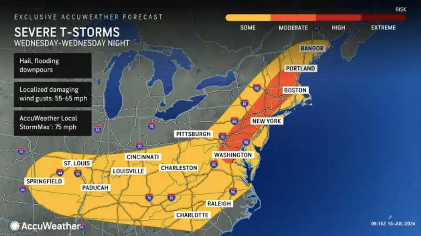
"Across the Northeast, thunderstorms will have plenty of heat and humidity to work with along with energy that may be left over from the storms that affect the Ohio Valley on Sunday," AccuWeather Meteorologist Tyler Roys said. Damaging winds and downpours are the main hazards, he said.
"The cities on the I-95 corridor could have thunderstorms, but the suburbs to their north and west will be more likely to have potentially severe thunderstorms," noted Roys.
Tuesday, July 16 will be sunny and slightly hotter than Monday's temps, the NWS said. In some parts of Pennsylvania, temps could be slightly cooler than predicted if storms happen before the late afternoon.
The highest potential for severe weather comes on Wednesday, July 17, AccuWeather forecasters are predicting.
"This time, the big cities from Washington, D.C. to Boston are likely to have storms during the afternoon commute or in the early evening hours, snarling travel for those driving home," Roys said.
A chance of storms remains on Thursday, July 18, which will be slightly cooler with temps around 85.
Click here to follow Daily Voice Hackensack and receive free news updates.