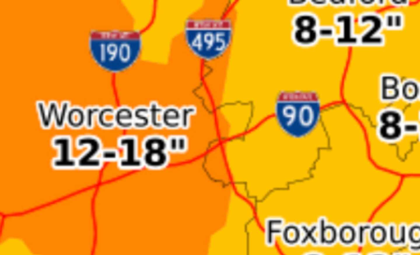

The National Weather Service says areas of Central and Western Massachusetts, as well as the Berkshires, may see up to 20 inches of snow accumulation in some places. Temperatures will be in the low to mid-20s.
A Winter Storm Warning has been put into effect from Wednesday, Dec. 16, 7 p.m. to Thursday, Dec. 17, 1 p.m.
In the Northern part of Worcester County, the forecast is for winds blowing at 15-20 mph with gusts of up to 30 mph after midnight, according to the National Weather Service.
Snow will start falling in the evening around 7 p.m. and may be heavy at times making it difficult to see.
The National Weather Services is predicting snow throughout the night and into the morning commute on Thursday, Dec. 17. Periods of patchy fog are anticipated.
In the northern part of the county, the snow accumulation is expected to be 10-14 inches.
As for the rest of the county, the forecast calls for 11-17 inches of total snow accumulation.
As a precursor to the snowstorm, on Wednesday people can expect to experience increasing clouds, cool, dry air, strong winds, and minor coastal flooding.
Click here to follow Daily Voice Worcester and receive free news updates.