


It will arrive after a dry weekend.
There will be a mix of sun and clouds on Sunday, March 22 with a high temperature around 40 degrees with wind-chill values between 20 and 30.
Clouds then will roll in after nightfall in advance of the storm as the low temperature drops to the upper 20s inland and the lower 30s farthest south.
At this point, the most likely time frame for the accumulating snowfall to arrive in those areas farther inland is around noontime Monday, March 23. Snow could continue at times during the afternoon, followed by a mix of snow and rain, then showers in the evening.
North of I-287 and the Merritt Parkway and south of I-84, about an inch of accumulation is expected, with 2 to 3 inches possible north of I-84.
Farthest north, as much as 3 to 6 inches of snowfall is possible in northernmost Litchfield County in Connecticut as well as parts of Northern Orange County, Dutchess, Ulster and Sullivan counties in New York.
About a half-inch of accumulation is possible in New York City, Long Island, southern Westchester and coastal Connecticut.
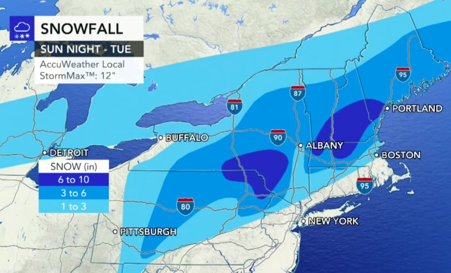
For a look at projected snowfall totals, see the first and second images above. A look at counties where winter weather advisories (blue) and winter storm watches (light blue) are in effect is shown in the third image above. Projected storm arrival times are shown in the fourth image above.
Monday's high temperature will be in the upper 30s to low 40s.
The chance for precipitation will end just after midnight on Tuesday, March 24 before skies become mostly sunny with the high temperature climbing into the low to mid 50s.
Check back to Daily Voice for updates.
Click here to follow Daily Voice Wilton and receive free news updates.