
Current forecast models have the time frame for the system starting overnight Thursday evening, Feb. 22 into early Friday afternoon, Feb. 23. (See the first image above from AccuWeather.com.)
But only those in northernmost areas should worry about having to get snow shovels ready.
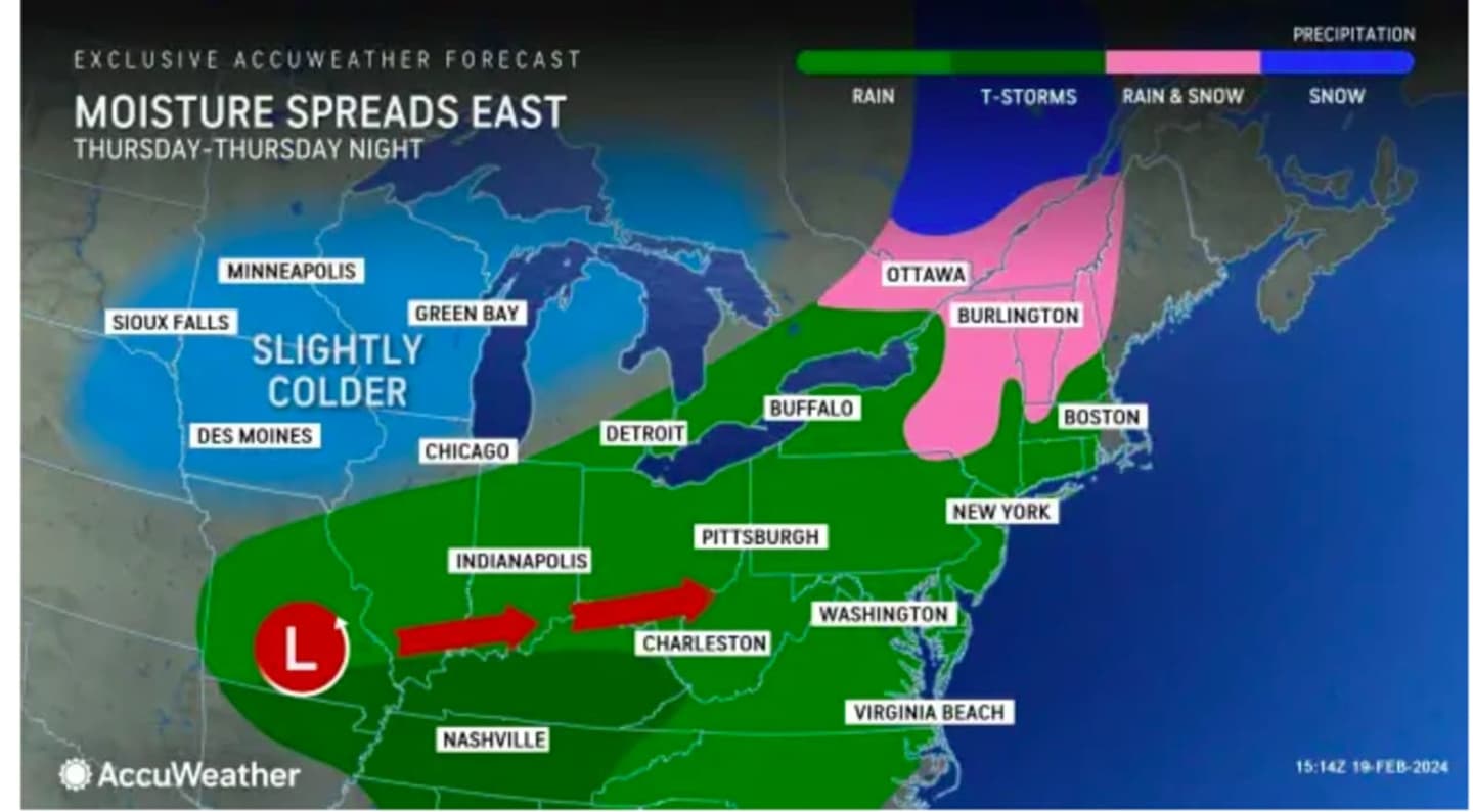
Temperatures should stay just above the freezing mark during that time in much of the region, except farthest north, where snow is forecast in upstate New York and Northern New New England. (Click on the second image above.)
The days leading up to the storm's arrival will be dry and seasonable, according to the National Weather Service.
Look for sunny skies on Tuesday, Feb. 20 with a high temperature in the mid- to upper 30s, and wind-chill values about 10 degrees colder.
It won't be as cold on Wednesday, Feb. 21, with the high temperature around 40 degrees and sunny skies.
Thursday will be mainly cloudy during the day with a high temperature managing to reach the low 40s farthest south.
Clouds will increase Thursday night in advance of the storm on Friday.
Current projections have the storm moving from west to east into the region starting between 11 p.m. Thursday and 1 a.m. Friday.
There's still uncertainty surrounding the track, timing, strength, and range in temperatures.
Check back to Daily Voice for updates.
Click here to follow Daily Voice Trumbull-Monroe and receive free news updates.