

The time frame for storm activity from the system moving from west to east is from around 1 p.m. to 7 p.m. on Saturday, Nov. 13, according to the National Weather Service. During that time, isolated tornadoes are also possible, the weather service said.
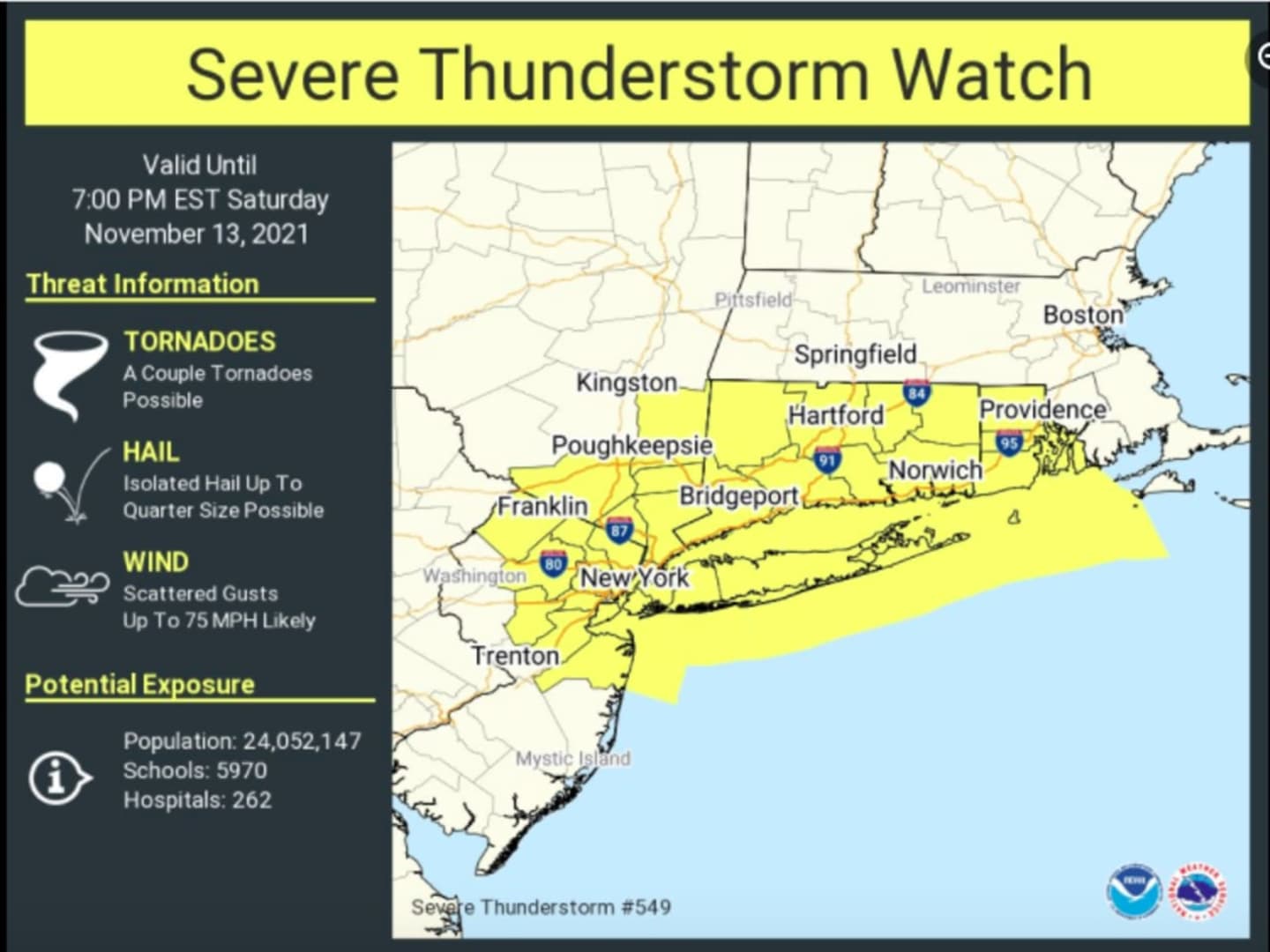
See the first image above for areas (in yellow) where a Severe Thunderstorm Watch is in effect until 7 p.m. Saturday. The watch went into effect at 12:30 p.m. Saturday.
This line began developing over western portions of New Jersey and the Lower Hudson Valley after midday and could produce wind gusts of 40 to 50 miles per hour, brief heavy rain of one quarter to one-half inch, and small hail are possible as the line moves through, the weather service said.
The strongest thunderstorms could produce damaging wind gusts over 60 mph and hail close to 1 inch in diameter.
Some downed trees, limbs, and power lines may occur, according to the weather service.
- For a look at the area (in yellow) with the highest chance of seeing severe weather on Saturday, click on the second image above.
- A projected image by the National Weather Service for 3 p.m. Saturday showing the line of the severe storm (in yellow and orange) can be seen by clicking on the third image above.
Rain is expected to change to snow in the highest peaks of the southern Adirondacks, the Berkshires, southern Green Mountains, and eastern Catskills Saturday afternoon and evening. Accumulations of 1 to 2 inches of snow are possible in parts of northern New York and Vermont.
Check back to Daily Voice for updates.
Click here to follow Daily Voice Shelton and receive free news updates.