Find Your Daily Voice
 45°
45°
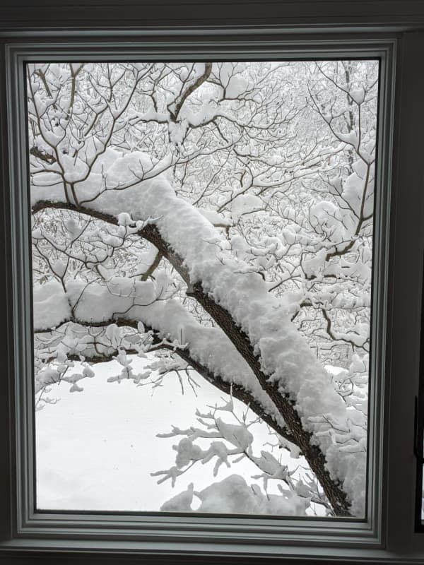
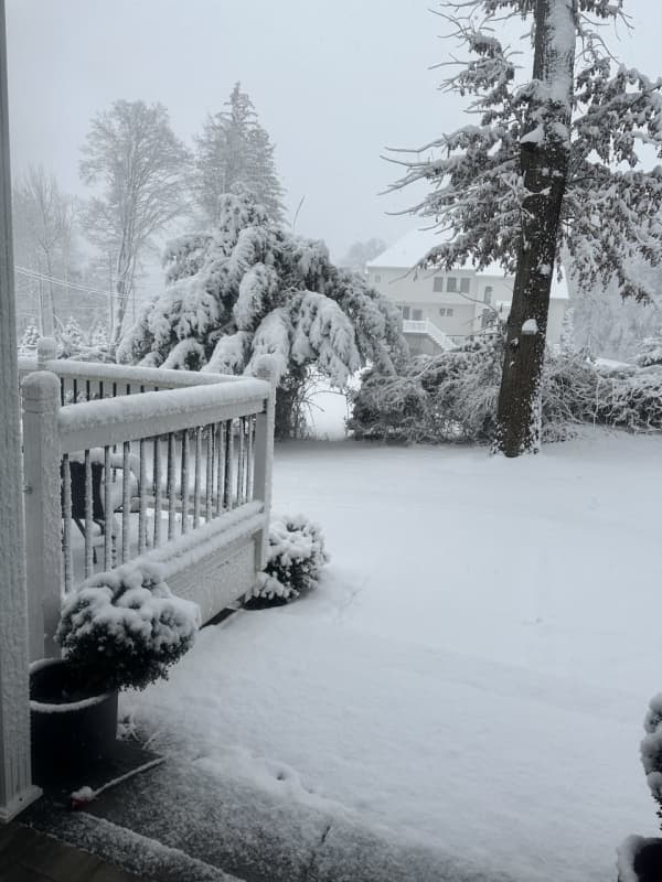
Post-Thanksgiving Storm Strengthens As It Heads Toward Northeast
A coastal storm intensifying in the mid-Atlantic will bring widespread rain with sleet and snow in some interior locations in the Northeast at the tail end of Thanksgiving weekend, affecting travel.
The time frame for the system is late Sunday afternoon, Nov. 26 into the early morning hours of Monday, Nov. 27, according to the National Weather Service.
"On Sunday, rain will mainly be confined to eastern Virginia, Maryland, and Delaware before spreading into New Jersey, Pennsylvania, and New York by Sunday night," according to AccuWeather.com. "By Monday, rain will primarily focus acros…
Forecasters Eyeing Potential Tropical System As End Of Hurricane Season Nears
With just one week remaining in the 2023 hurricane system, forecasters are monitoring a system that could form in the Atlantic.
It's located in the central subtropical Atlantic.
"This system could become a subtropical or tropical storm late this week or over the weekend," the National Hurricane Center said in a statement issued early Thanksgiving morning, Thursday, Nov. 23.
No matter what happens with the system, the 2023 hurricane season, which began on Thursday, June 1, and ends on Thursday, Nov. 30, will have a higher number of named storms compared to the historica…
Taurid Meteor Shower Peaks This Weekend: Best Places To See Falling Stars
If you're looking to wish upon a shooting star, this is the weekend to do it.
The Northern Taurid — the second half of the Taurid Meteor Shower — peaks on Saturday, Nov. 11 and Sunday, Nov. 12, according to Space.com.
"These showers produce infrequent, slow and long-lasting meteors associated with comet Encke, a small comet with a nucleus measuring approximately 2.98 miles (4.8 km) in diameter," the website says.
Taurid meteors, or "Halloween Fireballs," are visible from anywhere on Earth, except for the South Pole.
"The best time to look for Taurids is after midnight, when Taurus i…