The calendar flipped from March to April on Monday, bringing storms and whipping winds that are expected to last through the beginning of the week.
On April 1, the National Weather Service issued an alert advising that a Flood Watch is in effect for parts of the region, with isolated flooding most likely near the Maryland-Pennsylvania border.
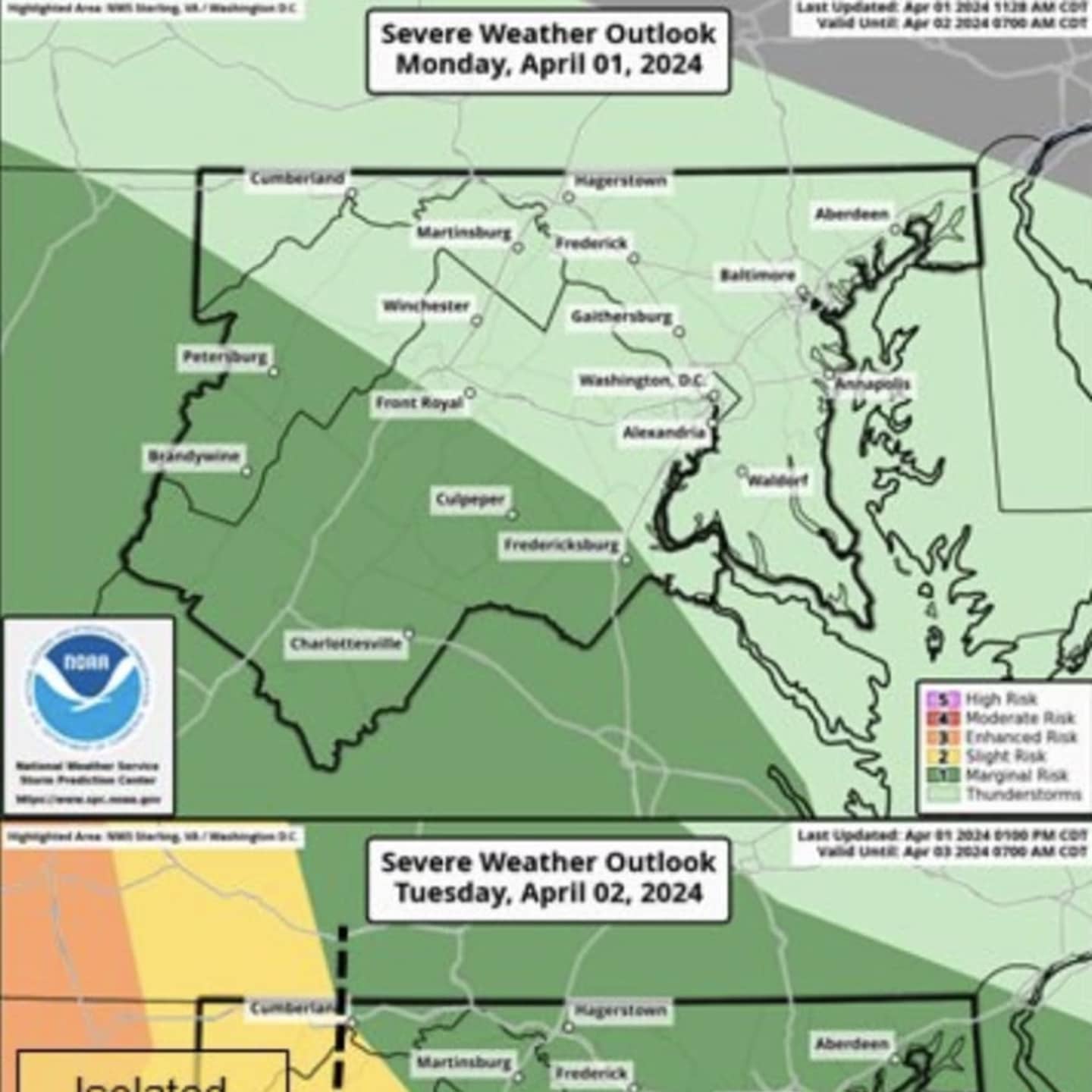
There is also a threat of damaging wind gusts, large hail, and an isolated tornado threat, according to forecasters lasting through Tuesday, April 2.
Temperatures are expected to hover in the 50s and 60s through the beginning of the week before dipping on Thursday and Friday, when there will be a chance of snow and heavy wind conditions.
"A few severe thunderstorms with damaging wind gusts and large hail are possible along and south of Highway 50 and Interstate 66 late this afternoon into early tonight," according to the National Weather Service.
"A few severe thunderstorms with damaging wind gusts and large hail are possible on both Tuesday and Wednesday. Isolated instances of flooding are possible to the north of I-70 on Tuesday.
"There is an enhanced winter storm threat Wednesday night through Friday, with the greatest threat late Thursday into early Friday. Travel disruptions and closures are possible should the threat materialize."
Want breaking news in the DMV as it happens, or want to contribute? Join the DMV All Incidents Facebook group.
Click here to follow Daily Voice Fairfax and receive free news updates.