Subscribe
51°

Frost, Freeze Threat To Expand: Areas Facing Greatest Risk
The next overnight chill could leave a mark long after temperatures rebound.
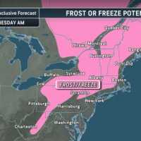
The National Weather Service has issued frost advisories from 11 p.m. Tuesday, Oct. 6, through 9 a.m. Wednesday, Oct. 7, for several inland areas. They include New York’s Orange and Putnam counties, interior southern Connecticut, and portions of Massachusetts, according to its New York and Boston offices.
The same advisory window covers Pennsylvania’s Poconos and Sussex County, New Jersey, the NWS said.
Sensitive plants face the immediate threat. AccuWeather advises covering vulnerable vegetation or bringing it in…
Power Outages Soar Past 100K After Severe Storms Slam Pennsylvania Again
More than 100,000 homes and businesses were without power across Pennsylvania on Friday, Sept. 4, after another round of severe storms brought destructive winds, torrential rain, flooding, and tornado warnings.
Approximately 102,700 customers remained in the dark Friday morning, more than twice the 43,000 reported Thursday morning and five times Wednesday afternoon’s total, according to PowerOutage.us.
The latest storms shifted the heart of the outage crisis to western Pennsylvania. The hardest-hit counties included:
Westmoreland County: 42,045 outages.
Allegheny County: 20,667 outages.
C…
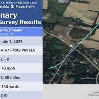
2 Tornadoes Tear Through PA, Including Lancaster, As EF2 With 120 MPH Winds Rips Off Roofs
Two tornadoes tore through York and Lancaster counties within minutes of each other, including an EF2 packing 120 mph winds that ripped roofs off parts of Eastern York High School, the National Weather Service confirmed Friday night, Aug. 21.
The stronger tornado touched down south of Wrightsville at 4:24 p.m. Thursday, Aug. 20, carving a 1.07-mile path through eastern York County before lifting just two minutes later, according to the NWS damage survey.
Just four minutes after that tornado lifted, an EF1 with estimated peak winds of 100 mph touched down in Columbia Borough, where buildings…
More Winter Weather Alerts Issued In NJ, PA As Tuesday Storm Aims At Morning Commute
Winter weather alerts have been issued across North Jersey and eastern Pennsylvania ahead of Tuesday’s storm, which is expected to bring several inches of snow and slippery roads during the morning commute, according to the National Weather Service.
A Winter Storm Watch is in effect for Sussex County, where 4 to 7 inches of snow and snowfall rates of up to 1 inch per hour are possible.
Winter Weather Advisories have been issued for Hunterdon, Morris, Warren, and Western Passaic counties, forecasters said.
In Pennsylvania, winter weather advisories cover Berks, Lehigh, Northampton, Upper Bu…
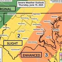
Tornado, Flood, Hail Threat As ‘Extreme Thunderstorms’ Slam Region
Wild winds, large hail, floods, and possible tornadoes may roll through the region overnight, forecasters are warning.
The National Weather Service issued a "Level 3 High Impact Severe Weather Threat" on Thursday, June 19, as storms begin hitting the area.
12:24pm CDT #SPC_MD 1364 , #njwx #pawx #dewx #mdwx #vawx #dcwx #wvwx, https://t.co/Y7ej7h7rco pic.twitter.com/q6cAaizrQk — NWS Storm Prediction Center (@NWSSPC) June 19, 2025
Officials also issued severe thunderstorm and flood warnings for parts of Virginia and western Maryland.
"Severe Thunderstorm Watch in effect for a large porti…