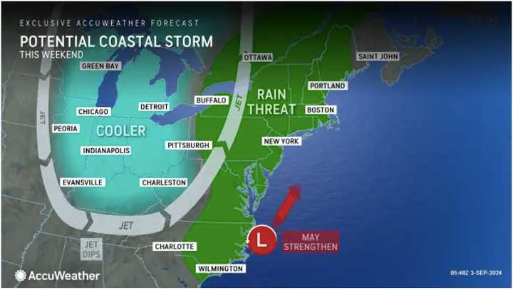
According to AccuWeather.com, the system's current projected timing is Saturday, Sept. 7. (See the first image above.)
A coastal storm is expected to arrive in the region just as the system makes its way to the Northeast from the northern Plains, AccuWeather says.
Strong rip currents, beach erosion, and rough surf are expected along a wide area marked in red in the second image above.
"The weekend looks rather wet from Pennsylvania, Maryland, and New York on eastward into New England," AccuWeather Senior Meteorologist Tyler Roys said. "In addition to bringing a 12-hour period of soggy weather, it's not out of the question that this storm could bring drenching downpours."
Plenty of blue skies and pleasant conditions will prevail in the days before the stormy first half of the weekend, according to the National Weather Service.
After a fall-like feel to the start of the day on Tuesday, Sept. 3, temperatures will rise to the low 70s.
The high temperatures will be in the mid-70s on Wednesday, Sept. 4, and Thursday, Sept. 4, with sunny skies both days.
Friday, Sept. 5, will have a mix of sun and clouds, with a high temperature in the upper 70s to around 80 degrees.
Clouds will increase Friday night ahead of showers arriving Saturday morning. Thunderstorms are expected to arrive early afternoon and continue through the evening.
The heaviest rainfall is expected Saturday night.
Storm activity could continue into the early morning hours of Sunday, Sept. 8.
There's still uncertainty surrounding the exact track and timing of the merging systems.
Check back to Daily Voice for updates.
Click here to follow Daily Voice Poughkeepsie and receive free news updates.

