The system is now due to arrive just before daybreak.
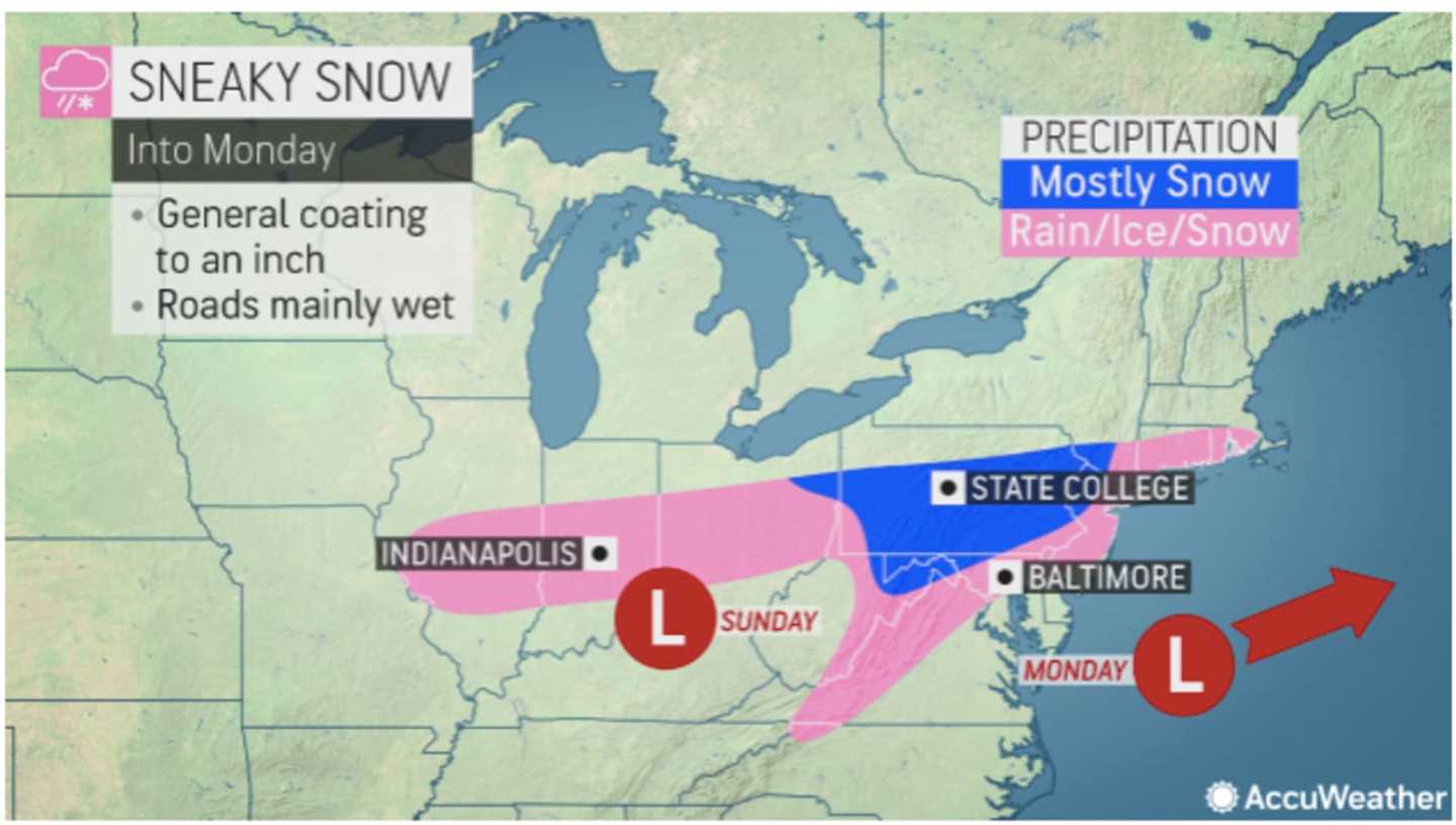
Snow accumulation of a coating to an inch is possible in the areas shown in blue in the image above from AccuWeather.com.
The system is expected to wind down by mid-morning on Monday, followed by gradual clearing as the high temperature climbs into the low 40s.
It will be dry Tuesday, Jan. 10 through Thursday, Jan. 12 before the expected arrival of a cross-country system overnight Thursday into Friday, Jan. 13, with unsettled weather expected to continue to Saturday, Jan. 14.
There's uncertainty surrounding its potential strength, track, timing, and temperatures when it moves through the region.
Check back to Daily Voice for updates.
Click here to follow Daily Voice Massapequa and receive free news updates.