
Clouds will thicken quickly Wednesday morning, Feb. 22 before precipitation develops in the afternoon, mainly in the form of rain closer to the coast, but with sleet and snow also possible, and a wintry mix expected farther north and inland, according to the National Weather Service.
Areas mainly north of the I-84 corridor will continue to see freezing rain and snow at times Wednesday night.
"There remains some uncertainty as to how long some of the valleys well inland will hold on to surface cold air resulting in at least a period of freezing rain," the National Weather Service said in a statement on Wednesday morning. "If the cold air doesn't get scoured out, then pockets of localized freezing rain may linger well to the northwest later tonight."
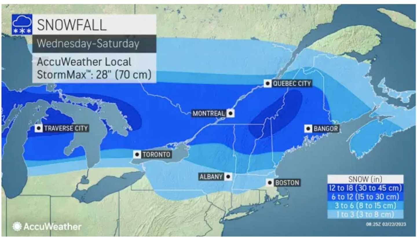
Areas in northern New York and northern New England could see more than a foot of snowfall. (For projections, see the first image above from AccuWeather.com.)
It will remain unsettled on Thursday, Feb. 23, with some lingering showers at times.
Skies will gradually clear overnight, leading to a mostly sunny day on Friday, Feb. 24. It will be blustery during the day and into the evening.
It then turns much colder late Friday and into the first half of the weekend, according to the National Weather Service.
Wake-up wind chills Saturday morning, Feb. 25 will be in the teens on a day in which the high temperature will be right around the freezing mark.
Check back to Daily Voice for updates.
Click here to follow Daily Voice Massapequa and receive free news updates.