
The projected timing for the storm is from late Sunday night, Jan. 28 into early Monday afternoon, Jan. 29, according to the National Weather Service.
Areas farthest south, including New York City and Long Island, are expected to see a mix of snow, sleet, and rain.
"Enough snow may fall to bring a small accumulation on non-paved surfaces, especially to areas outside of the immediate New York City metro area," said AccuWeather Meteorologist Dean DeVore.
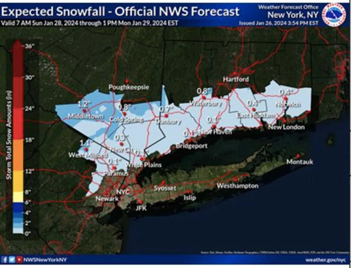
In the first image above from the National Weather Service, areas farther north in the region could see around 2 inches of snowfall.
For the latest snowfall projections for the entire Northeast from AccuWeather.com, click on the second image above, with areas in the darkest shade of blue projected to see between 6 inches and a foot, 3 to 6 inches in the parts of the region shown in Columbia blue, and 1 to 3 inches in the areas in sky blue.
After several days of rain and showers, it will dry out on Saturday, Jan. 27 but clouds will linger with peeks of sun and a high temperature in the mid-40s before the latest round of unsettled weather arrives overnight into Sunday.
Sunday will be raw with cooler temperatures and rain likely at times during the day and again at night when the storm will move in.
The high temperature Sunday will range from the upper 30s to around 40 degrees, before dipping below freezing overnight.
Monday's high temperature will hold steady at around the freezing mark to the mid-30s with mostly cloudy skies.
It will be mostly sunny and cold Tuesday, Jan. 30 with a high temperature in the mid-30s.
The outlook for Wednesday, Jan. 31 calls for partly sunny skies and a high in the mid to upper 30s.
Check back to Daily Voice for updates.
Click here to follow Daily Voice Massapequa and receive free news updates.