Rainfall is picking up in intensity across the area Saturday morning, March 23, with the heaviest rain expected for the late morning and afternoon, according to the National Weather Service.
Rain will taper off by early Saturday evening evening for most, and a few hours later for far eastern sections of the Northeast.
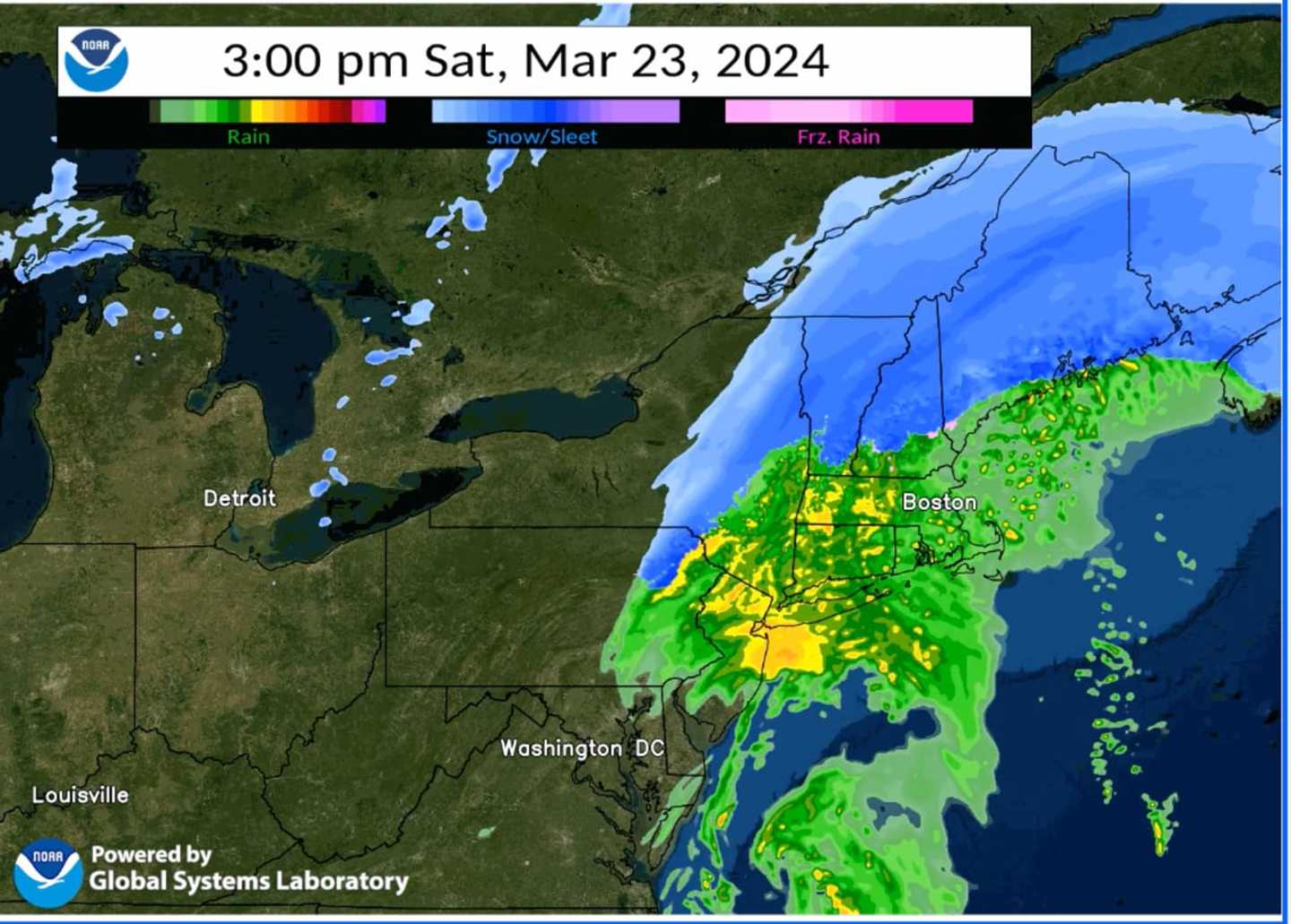
For a projected radar image of the Northeast for 3 p.m. Saturday, see the first image above.
A widespread 2.5 to 3.5 inches of rainfall is expected from the storm, with locally higher amounts.
The strongest wind gusts of about 30 miles per hour are expected late Saturday afternoon into Saturday night. Gusts could be as high as 45 mph along the coast.
Saturday's high temperature will be in the low 50s.
Overnight Saturday into Sunday, March 24, rain could again mix with light snow before the system winds down shortly after daybreak on Sunday.
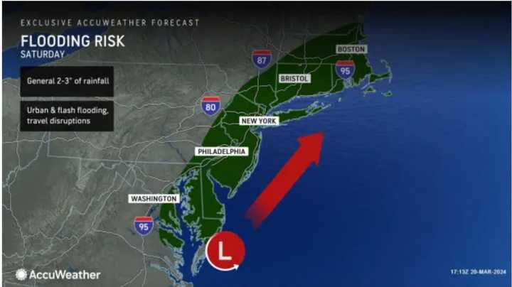
Flooding is possible over a broad area in the Northeast but is most likely along coastal areas. (Click on the second image above from AccuWeather.com.)
Skies will gradually become partly to mostly sunny Sunday. It will be breezy with a high temperature in the mid-40s.
The outlook for Monday, March 25, and Tuesday, March 26 calls for mostly sunny skies and a high temperature in the upper 40s to around 50 degrees both days.
Unsettled weather is expected to return Wednesday, March 27 with mostly cloudy skies and a chance of rain starting after around daybreak. The high temperature will be in the low 50s.
Check back to Daily Voice for updates.
Click here to follow Daily Voice Massapequa and receive free news updates.