
According to the National Weather Service, Friday, July 5, will be muggy and humid, with high temperatures in the upper 80s and a heat index in the 90s. Morning fog and cloudy conditions will be followed by partly sunny skies.
Afternoon showers are possible, and the first round of thunderstorms will arrive late afternoon. The window for storm activity will last into late Friday night.
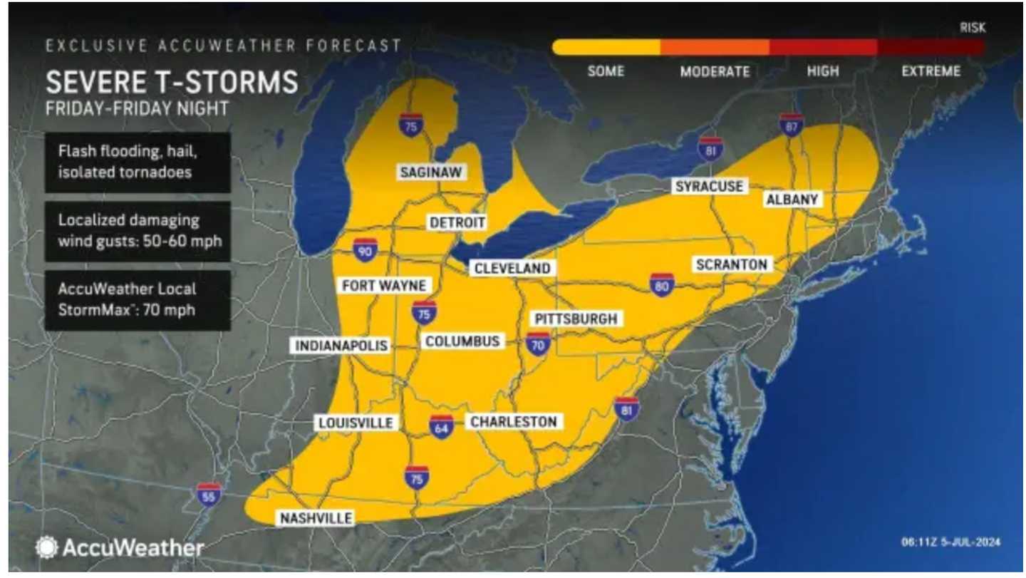
Areas in yellow in the first image above from AccuWeather.com are most likely to see severe thunderstorms
The next round of storms is due to arrive Saturday afternoon, July 6 with storms, some of which will be severe, continuing into the evening. (Click on the second image above.)
About a half-inch of rainfall is expected.
Sunday, July 7, is expected to be precipitation-free, with partly sunny skies and a high temperature in the upper 80s.
It will be warm again on Monday, July 8, with temps topping out near 90 degrees, but with less humid conditions.
The outlook for Tuesday, July 9 calls for partly sunny skies and temps again in the upper 80s.
With humid air returning, afternoon showers are possible, with a chance of thunderstorms beginning in the early evening.
Check back to Daily Voice for updates.
Click here to follow Daily Voice Massapequa and receive free news updates.