The projected timing for the complex system is from late Sunday night, Jan. 28 into around midday Monday, Jan. 29, according to the National Weather Service.
"The storm will move northward only so far before turning to the east as colder air invades from the north and west," according to AccuWeather.com.
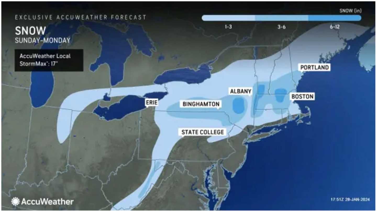
For the latest snowfall projections from AccuWeather.com, released Sunday afternoon, see the image above, with areas in the darkest shade of blue projected to see between 6 and 12 inches, 3 to 6 inches in the parts of the region shown in Columbia blue, and 1 to 3 inches in the areas in sky blue.
Areas farthest south, including New York City, Long Island, and much of coastal New England are expected to see a mix of snow, sleet, and rain, with a coating to an inch of snowfall possible.
The temperature will hold steady at around the freezing mark to the mid-30s Monday morning before climbing to the upper 30s to around 40 degrees during the day with mostly cloudy skies throughout the day.
It will be partly sunny and cold Tuesday, Jan. 30 with a high temperature in the mid-30s.
The outlook for Wednesday, Jan. 31 calls for mainly cloudy skies and a high temperature in the upper 30s.
Sunshine is expected to return as the calendar flips to February with a high temperature climbing to the low to mid-40s on Thursday, Feb. 1.
Check back to Daily Voice for updates.
Click here to follow Daily Voice Massapequa and receive free news updates.