The good news is that, other than a passing snow shower here or there, most of the day Tuesday will be free of snowfall in Putnam and Dutchess counties.
Now, the not-so-good news.
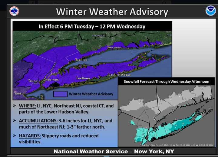
Yet another round of snow will then be arriving in the area Tuesday night. It's expected to bring as much as 2-3 inches of snow to parts of the Hudson Valley and as much as 6 inches across northeast New Jersey, New York City and Long Island, according to the latest update from the National Weather Service.
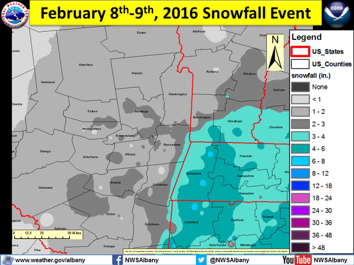
Putnam and Dutchess should escape the brunt of the snowfall, seeing just a dusting to less than an inch of accumulation during the window in which the new system is expected -- from around 11 p.m. Tuesday through the morning on Wednesday.
A Winter Weather Advisory that includes Westchester and Rockland takes effect at 6 p.m. Tuesday and lasts through Wednesday at noon.
Wednesday's high temperature will reach the mid 30s under cloudy skies.
There's a slight chance of snow showers on Thursday, with the high temperature once again only reaching about 32.
Friday will bring increasing clouds with highs in the upper 20s.
The inverted trough offshore, which has resulted in the bursts of snow the last few days, will be followed by arctic air and plummeting temperatures for the weekend.
Check back to Daily Voice for updates.
Click here to follow Daily Voice Mahopac and receive free news updates.