One-Week Forecast

  1. Current
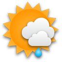
    Partly Cloudy 28°
    • 28°
    • 24°
    Partly Cloudy
  2. Tue 12/24
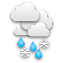
    Snow
    • 39°
    • 28°
    Snow
  3. Wed 12/25
    Partly Sunny
    • 37°
    • 24°
    Partly Sunny
  4. Thu 12/26
    Mostly Sunny
    • 37°
    • 26°
    Mostly Sunny
  5. Fri 12/27
    Partly Sunny
    • 41°
    • 30°
    Partly Sunny
  6. Sat 12/28
    Chance Rain/Snow
    • 44°
    • 35°
    Chance Rain/Snow
  7. Sun 12/29
    Chance Rain
    • 48°
    Chance Rain
New Update - Christmas Eve Clipper To Bring Snow, Slippery Travel: Here's Timing New Update - Christmas Eve Clipper To Bring Snow, Slippery Travel: Here's Timing
New Update - Christmas Eve Clipper To Bring Snow, Slippery Travel: Here's Timing A quick-moving Alberta Clipper will sweep west to east on Christmas Eve, bringing a mix of snow, sleet, and rain, causing slick travel. Skies will be mostly sunny on Monday, Dec. 23, with high temperatures ranging from the mid-20s. to around freezing. Clouds will increase at night as the system moves in. Precipitation is expected from about just before daybreak to the early afternoon on Christmas Eve, with mostly cloudy skies  throughout the day on Tuesday, Dec. 24. Slippery travel is expected in the shaded areas the AccuWeather map in the first image above. In areas farther north an…
These Spots In Northeast Will See Most Snowfall From Christmas Eve Clipper System These Spots In Northeast Will See Most Snowfall From Christmas Eve Clipper System
These Spots In Northeast Will See Most Snowfall From Christmas Eve Clipper System Parts of the Northeast will see up to a half-foot of snow from an Alberta Clipper that will sweep through from west to east on Christmas Eve. On Monday, Dec. 23, expect mostly sunny skies with temperatures around freezing. Clouds will increase at night as the system moves in. Precipitation, including snow, sleet, and rain, is expected from about 1 a.m. to 1 p.m. on Christmas Eve, with mostly cloudy skies on Tuesday, Dec. 24. Northern and inland areas will likely see heavier accumulations, with 1 to 3 inches expected in lighter blue zones in the first image above from AccuWeather. Between …
Christmas Eve Clipper Storm Will Bring Snow, Sleet, Rain To Northeast: Here's Timing Christmas Eve Clipper Storm Will Bring Snow, Sleet, Rain To Northeast: Here's Timing
Christmas Eve Clipper Storm Will Bring Snow, Sleet, Rain To Northeast: Here's Timing It's beginning to look a lot like much of the Northeast will see a new round of snowfall on Christmas Eve. Ahead of the storm, Sunday, Dec. 22, will remain sunny but bitterly cold as Arctic air continues to grip the region, according to the National Weather Service. On Monday, Dec. 23, expect mostly sunny skies with temperatures around freezing. Clouds will increase at night as an Alberta Clipper system moves in from the west. Precipitation, including snow, sleet, and rain, is expected from about 1 a.m. to 1 p.m. on Christmas Eve, with mostly cloudy skies on Tuesday, Dec. 24. A mix of rai…
5 Inches Of Snow Fell In Parts Of New Jersey: See How Much Your Town Got 5 Inches Of Snow Fell In Parts Of New Jersey: See How Much Your Town Got
5 Inches Of Snow Fell In Parts Of New Jersey: See How Much Your Town Got A winter storm dropped varying amounts of snow across New Jersey overnight Friday, Dec. 20, into Saturday morning, Dec. 21.  Snowfall totals ranged from trace amounts in South Jersey to more than 5 inches in parts of North Jersey, creating slippery conditions on roadways as temperatures remained below freezing, according to data from the National Weather Service. Sussex and Morris counties recorded the highest snowfall, with Sparta Township leading at 5.5 inches and Randolph Township close behind at 5.3 inches. Meanwhile, southern counties like Atlantic and Cumberland reported only tra…
White Christmas Eve? Here's When Next Round Of Snow Could Be Coming White Christmas Eve? Here's When Next Round Of Snow Could Be Coming
White Christmas Eve? Here's When Next Round Of Snow Could Be Coming The next round of snowfall during what's been an active weather pattern could be coming on Christmas Eve in much of the Northeast, with snow showers possible in parts of the mid-Atlantic. See the image above from AccuWeather for a look at areas where forecast models say snow and snow showers are possible along the East Coast on Tuesday, Dec. 24 (shown in the lighter shades of blue). A weak storm is likely to move quickly eastward from the Great Lakes and Ohio Valley during the day on Dec. 24 and then through the central Appalachians, the mid-Atlantic and New England from the evening hours o…
1 To 3 Inches Of Snow Expected This Weekend In Parts Of NJ, PA: Here's Your Forecast 1 To 3 Inches Of Snow Expected This Weekend In Parts Of NJ, PA: Here's Your Forecast
1 To 3 Inches Of Snow Expected This Weekend In Parts Of NJ, PA: Here's Your Forecast A weak winter system is expected to bring a mix of light snow and rain to parts of New Jersey and Pennsylvania beginning Friday morning, Dec. 20, and lasting into early Saturday, Dec. 21, the National Weather Service (NWS) in Mount Holly said. A weak system will move through Friday into early Saturday morning, bringing a mixed bag of wintry weather across the... Posted by US National Weather Service Philadelphia/Mount Holly on Thursday, December 19, 2024 The Poconos and northwest New Jersey are expected to see the most snow, with accumulations ranging from 1 to 3 inches. Areas north…
Long-Range Forecast Reveals Separate Storm Chances Christmas Week Long-Range Forecast Reveals Separate Storm Chances Christmas Week
Long-Range Forecast Reveals Separate Storm Chances Christmas Week Dreaming of a White Christmas? You may get your wish. Long-range weather models indicate the chance for two separate storm systems during Christmas Week, occurring right before and after Wednesday, Dec. 25. The first system is anticipated on Monday, Dec. 23. With overnight low temperatures in the upper teens and low 20s, and daytime highs around the freezing mark, the precipitation is likely to fall as snow.   The second chance for a storm that week will occur on Thursday, Dec. 26, when high temperatures are expected to reach the upper 30s to low 40s, which could result in r…
What Are Snow Squalls? Winter Weather Hazard Forecast In NJ, PA: Here's What To Know What Are Snow Squalls? Winter Weather Hazard Forecast In NJ, PA: Here's What To Know
What Are Snow Squalls? Winter Weather Hazard Forecast In NJ, PA: Here's What To Know A storm system moving in brings the potential for snow squalls, 55 mph winds, and frigid temps mid-week in New Jersey and Pennsylvania, forecasters have said in a new update. ⚠️❄️🌬️ Not much change to the forecast for tonight through Thursday. Some snow showers may result in some light... Posted by US National Weather Service Philadelphia/Mount Holly on Wednesday, December 4, 2024 A powerful cold front is set to sweep through the region tonight into Thursday, Dec. 5, bringing snow showers, potential travel hazards, and wind gusts as high as 55 mph, according to the National Weather …
Brace For Impact: Snow, Gusty Winds To Sweep Through New Jersey Brace For Impact: Snow, Gusty Winds To Sweep Through New Jersey
Brace For Impact: Snow, Gusty Winds To Sweep Through New Jersey A powerful cold front is set to move through the region mid-week, bringing light snow and widespread gusts of 40-50 mph, with higher totals in some areas, according to the National Weather Service (NWS). The storm is expected to bring rain and snow showers starting Wednesday night, Dec. 4, with minor snowfall accumulations possible through Thursday morning. Most areas in New Jersey will see less than one inch of snow, while higher elevations in northern counties, such as Sussex and Morris, could receive up to two inches. The bigger concern is the strong winds forecasted for Thursday morning…
Here's How Many Major Hurricanes Hit During 2024 Atlantic Season Here's How Many Major Hurricanes Hit During 2024 Atlantic Season
Here's How Many Major Hurricanes Hit During 2024 Atlantic Season It's a wrap. The 2024 Atlantic hurricane season officially ended on Saturday, Nov. 30, with above-average activity in terms of the number of named storms, hurricanes, and major hurricanes. In total, there were: 18 named storms 11 hurricanes 5 major hurricanes (Category 3 or higher) This season was about 34 percent above the long-term average for Accumulated Cyclone Energy (ACE), which measures the strength and duration of tropical storms and hurricanes.  Below is a summary of the season’s named storms, with the five Cat 3 or higher hurricanes in bold: Tropical Storm Alberto (June 1…
Separate Snowmaking Storms Could Mark December's Opening Weeks: Long-Range Outlook Separate Snowmaking Storms Could Mark December's Opening Weeks: Long-Range Outlook
Separate Snowmaking Storms Could Mark December's Opening Weeks: Long-Range Outlook The arrival of an Arctic blast of cold air could be followed by separate snowmaking storms during the first two weeks of December. Tuesday, Dec. 3, will mark the start of a string of days in which Alberta Clipper systems with fast-falling snowfall are possible in these areas shown in pink and blue in the image above from AccuWeather. According to current forecast models, the highest likelihood for snowfall in the Northeast is overnight Wednesday, Dec. 4 into Thursday, Dec. 5, according to the National Weather Service. Areas farther south will likely see mainly snow showers but accumul…
Rain, Winds, Coastal Storm? What NJ Can Expect From The Weather This Thanksgiving Week Rain, Winds, Coastal Storm? What NJ Can Expect From The Weather This Thanksgiving Week
Rain, Winds, Coastal Storm? What NJ Can Expect From The Weather This Thanksgiving Week The National Weather Service in Mount Holly is forecasting a mix of sunny skies, mild temperatures, and rain chances this Thanksgiving week, with a potential coastal storm expected to impact travel plans Thursday into Friday. Here's your day-by-day forecast this week through the holiday, according to the NWS: Sunday, Nov. 24: Expect mostly sunny skies with a high near 56°F. West winds will blow around 15 mph, with gusts as high as 30 mph. Tonight will be partly cloudy, with lows dropping to 33°F and calming winds. Monday, Nov. 25: Sunny and slightly warmer, with a high near 59°F.…
New Update: Thanksgiving Storm Will Dampen Travel With Mix Of Rain, Sleet, Snow New Update: Thanksgiving Storm Will Dampen Travel With Mix Of Rain, Sleet, Snow
New Update: Thanksgiving Storm Will Dampen Travel With Mix Of Rain, Sleet, Snow A new storm will bring a mix of snow, sleet, and rain on Thanksgiving and Black Friday, causing widespread disruptions for travel and holiday festivities. A pair of scenarios will be at play as the holiday week progresses, one of which could produce accumulating snow across portions of the Ohio Valley and Northeast, AccuWeather meteorologists say. "The first scenario involves a slow-moving storm, meaning potentially longer-lasting impacts from the Tennessee and Ohio valleys through the Northeast," says AccuWeather. "The second scenario sends the same storm farther south and off the Ca…
Snow Totals Climb With 20 Inches Recorded In This NJ Town: Check How Much Snow Your Area Got Snow Totals Climb With 20 Inches Recorded In This NJ Town: Check How Much Snow Your Area Got
Snow Totals Climb With 20 Inches Recorded In This NJ Town: Check How Much Snow Your Area Got Snowfall totals in New Jersey and Pennsylvania have surged higher than earlier reports, with some areas now measuring up to 20 inches, the National Weather Service announced Friday, Nov. 22. High Point, NJ, has officially recorded 20 inches of snow as of Friday morning, marking the highest total in the region.  In Pennsylvania, Richmondale follows closely with 19.5 inches, and Cortez reached 19 inches, highlighting the storm's significant impact on higher elevations. Other notable totals include 17.2 inches near Uniondale and 17 inches in Clifford, both in northeastern Pennsylvania. F…
Snow In New Jersey: School Closings, Delays Announced As Winter Weather Worsens Snow In New Jersey: School Closings, Delays Announced As Winter Weather Worsens
Snow In New Jersey: School Closings, Delays Announced As Winter Weather Worsens Heavy snowfall and hazardous road conditions have prompted school closures and delays across parts of North Jersey Friday, Nov. 22. Precipitation is expected to continue throughout the day, with snowfall accumulation most significant near and north of the Route 78 corridor in Pennsylvania and northwest New Jersey, according to the National Weather Service in Philadelphia/Mount Holly. Higher elevations are seeing the heaviest impact, officials said. A Winter Weather Advisory is in effect for portions of NE NJ and much of the Lower Hudson Valley from 7pm tonight... Posted by US National W…
Snow Could Fall In Parts Of NJ, PA After Rain: Here's Where, When Snow Could Fall In Parts Of NJ, PA After Rain: Here's Where, When
Snow Could Fall In Parts Of NJ, PA After Rain: Here's Where, When Cooler temperatures are here to stay for the week, with the National Weather Service forecasting rain and even snow in some parts of New Jersey this week (scroll for snow map). The National Weather Service in Mount Holly says that the cold front, which brought a 5- to 10-degree temperature drop, will continue to influence the region's weather. "Widespread rain, and even a little snow in the Poconos, will arrive for Wednesday night through Thursday night," officials said. According to AccuWeather, a storm system in the Great Lakes will shift to the Atlantic Coast.  "The rain may behave…
Newly Named Tropical Storm Sara Forms: Here's Latest Newly Named Tropical Storm Sara Forms: Here's Latest
Newly Named Tropical Storm Sara Forms: Here's Latest There's a brand-new tropical storm with just two weeks remaining in the 2024 Atlantic hurricane season. A system in the central Caribbean Sea called Tropical Depression 19 was upgraded to Tropical Storm Sara on Thursday afternoon, Nov. 14. It's now moving westward toward Central America.  Tropical storm warnings are in effect for parts of Honduras and Nicaragua.  "Residents in these areas should monitor the storm's progress and follow local advisories," the National Hurricane Center said. Current projections have the storm headed to Florida on Wednesday, Nov. 20. (See the …
Wildfire Smoke Blankets North Jersey As Pompton Lakes Blaze Grows To 100 Acres Wildfire Smoke Blankets North Jersey As Pompton Lakes Blaze Grows To 100 Acres
Wildfire Smoke Blankets North Jersey As Pompton Lakes Blaze Grows To 100 Acres Residents across North Jersey are facing worsening air quality due to smoke from a major wildfire burning in Pompton Lakes.  UPDATE: Unhealthy Air Quality Levels Reported In North Jersey As New 1,800-Acre Wildfire Rages Smoke from the Pompton Lakes wildfire. North Jersey Video Service or NJVS Dubbed the "Cannonball 3 Wildfire," the blaze has expanded to 100 acres with no containment, as per the latest update from the New Jersey Forest Fire Service. By late Friday night, Nov. 8, smoke from the raging Passaic County wildfire drifted as far as Fair Lawn, Hackensack, New Milfo…
Rafael Becomes Hurricane With 115 MPH Winds: Future Path Has Pair Of Possibilities Rafael Becomes Hurricane With 115 MPH Winds: Future Path Has Pair Of Possibilities
Rafael Becomes Hurricane With 115 MPH Winds: Future Path Has Pair Of Possibilities Tropical Storm Rafael has now become a hurricane, with its projected path now uncertain. It made landfall in western Cuba as a major Category 3 storm in Cuba late Wednesday afternoon, Nov. 6, with life-threatening storm surge, damaging hurricane-force winds, and destructive waves reported, along with 115 mph winds. Tropical storm conditions are then possible in the Florida Keys late in the day Wednesday and Wednesday night, the National Hurricane Center said. It could then extend to areas of the southeast US toward the end of the week, on Thursday, Nov. 7, and Friday, Nov. 8. Ano…
Multiple Systems Have Potential To Be Next Named Tropical Storm Of Hurricane Season Multiple Systems Have Potential To Be Next Named Tropical Storm Of Hurricane Season
Multiple Systems Have Potential To Be Next Named Tropical Storm Of Hurricane Season Three areas are being monitored for the potential to become the next named tropical storm of the 2024 Atlantic hurricane season, with one of them having a strong chance. In particular, an area in the southwest Caribbean has a high chance of development, according to an update Friday morning, Nov. 1 by the National Hurricane Center, rating the chance at 70 percent. It's expected to develop by the weekend with a depression possibly forming by early next week.  It's moving to the north/northwest slowly and and is expected to advance into the Gulf of Mexico next week.&…
Brief Cold Front Coming, Warm Weather Sticking Around In NJ, PA: Forecasters Brief Cold Front Coming, Warm Weather Sticking Around In NJ, PA: Forecasters
Brief Cold Front Coming, Warm Weather Sticking Around In NJ, PA: Forecasters A cold front will end the summer-like warmth in the Northeast — for now, forecasters say. "For the next seven to 10 days at least, warm days will outnumber chilly ones, relative to the historical average," AccuWeather Senior Meteorologist Brett Anderson said. "This means that when all the days are tallied up, temperatures will be several degrees above that historical average, which is slowly trending downward during November." The last few days have certainly felt like summer, but the weekend will be feeling more like autumn, forecasters say. Temperatures on Friday will be in the high 70s …
Latest Update: System In Tropics Could Become Next Named Storm Latest Update: System In Tropics Could Become Next Named Storm
Latest Update: System In Tropics Could Become Next Named Storm There is an increasing chance that a system now being monitored could develop into a tropical storm just as the 2024 Atlantic hurricane season enters its final month. "Broad low pressure is likely to form over the Caribbean in a few days and a tropical depression could form late this week or this weekend." the National Hurricane Center said in a statement on Monday, Oct. 28.  Water temperatures remain warm in the area where development is expected, which will further boost chances of formation. "I know there will be showers and thunderstorms in this zone this week," AccuWeat…
Next Named Tropical Storm Could Form Just As Final Month Of Hurricane Season Starts Next Named Tropical Storm Could Form Just As Final Month Of Hurricane Season Starts
Next Named Tropical Storm Could Form Just As Final Month Of Hurricane Season Starts A new system that could become a named storm could form just as the 2024 Atlantic hurricane season enters its final month. Click here for a new, updated story: Chances Increase System In Tropics Could Become Tropical Storm "Forecasters are focusing on the western and central Caribbean Sea which are expected to spawn the next tropical threat," according to AccuWeather. "There is a high chance of a tropical depression or storm forming in these waters du"ring late October and early November." AccuWeather pinpoints the time frame for possible development as between Wednesday, Oct. 30, and Fr…
Oscar Heading North After Making Landfall In Cuba As Hurricane Oscar Heading North After Making Landfall In Cuba As Hurricane
Oscar Heading North After Making Landfall In Cuba As Hurricane Oscar is now moving north after making landfall in eastern Cuba as a Category 1 hurricane. It's now a tropical storm on landfall on Sunday evening, Oct. 20 in eastern Cuba, where heavy rain will continue causing life-threatening flash flooding and mudslides on Monday, Oct. 21, according to the National Hurricane Center. Oscar formed rapidly over the weekend, After being upgraded to a tropical storm Saturday morning, Oct. 19, it strengthened to hurricane status just hours later. As it tracks north, Oscar will bring gusty winds and heavy rain to the southeastern Bahamas M…
Winter 2024-25 Forecast Released By NOAA National Weather Service Winter 2024-25 Forecast Released By NOAA National Weather Service
Winter 2024-25 Forecast Released By NOAA National Weather Service The National Oceanic and Atmospheric Administration (NOAA) Climate Prediction Center has just released its outlook for the winter of 2024-25. A“slowly-developing” La Niña is expected to shape weather throughout the country from December through February, NOAA says. The La Niña phenomenon occurs when water temperatures near the equator in the eastern Pacific Ocean remain below the historical average for an extended period, which can significantly influence weather patterns across North America, including the trajectory of snowstorms. “This winter, an emerging La Niña is anticipated to …
Freeze Warning: Temps To Dip Into 40s Tonight In Hudson County Freeze Warning: Temps To Dip Into 40s Tonight In Hudson County
Freeze Warning: Temps To Dip Into 40s Tonight In Hudson County The cold and cozy nights are here to stay, with temps expected to dip into the 30s across parts of New Jersey and Pennsylvania Wednesday night, Oct. 16, but with summer-like temps expected over the weekend, forecasters said. While Wednesday will be sunny with a high just below 60, temperatures could plummet to the high-30s or low-40s in New Jersey and Greater Philadelphia come nightfall, the National Weather Service said. In the Poconos and the northernmost parts of NJ, temperatures could dip as low as 30, the NWS said. Temperatures won't be quite as low along New Jersey's coast, rangi…
Most Snowfall Expected In These Areas This Winter: AccuWeather Releases Long-Range Outlook Most Snowfall Expected In These Areas This Winter: AccuWeather Releases Long-Range Outlook
Most Snowfall Expected In These Areas This Winter: AccuWeather Releases Long-Range Outlook AccuWeather meteorologists have just unveiled their forecast for the winter of 2024-25 and have released a map of where in the US the most snowfall is expected. In the image above, higher-than-average snowfall is predicted for those areas shown in light blue, with most areas in the Northeast are expected to receive more snow this season than last winter. Areas in the darker shade are expected to see below average snowfall in 2024-25, including in much of the Mid-Atlantic states. Click here for a new, related story: Winter 2024-25 Forecast Released By NOAA National Weather Service …
New Tropical System In Atlantic Being Watched By Forecasters New Tropical System In Atlantic Being Watched By Forecasters
New Tropical System In Atlantic Being Watched By Forecasters Forecasters are monitoring a new system in the eastern Atlantic Ocean. It's located a few hundred miles west of the Cabo Verde Islands in West Africa. "This system is forecast to move generally westward to west-southwestward," according to the National Hurricane Center, "and environmental conditions could become more favorable for gradual development by the middle to latter part of this week.  "A tropical depression could form as the system begins moving west-northwestward and approaches or moves near the Leeward Islands by the end of this …
Potential New Tropical Storm May Form In Same Area That Launched Helene, Milton Potential New Tropical Storm May Form In Same Area That Launched Helene, Milton
Potential New Tropical Storm May Form In Same Area That Launched Helene, Milton The same area that launched two major hurricanes in a two-week span could be the breeding ground for a potential new tropical system. "We expect another gyre to get going over Central America later next week," said AccuWeather Lead Hurricane Expert Alex DaSilva, "From this large, slowly spinning area of low pressure, a more distinct area of showers and thunderstorms may form, and from that, a tropical depression or tropical storm may evolve." The system could take two possible paths -- either northern (as Helene and Milton did) or southern. (See the first image above.) Meanwhile, …
Northern Lights Dazzle NJ Residents Northern Lights Dazzle NJ Residents
Northern Lights Dazzle NJ Residents Residents across the Northeast were dazzled by the Northern Lights, visible Thursday evening, Oct. 10. The purple and pink lights were visible due to a Solar Storm, or a Coronal Mass Ejection from the sun on Tuesday, Oct. 8 which arrived in the area Thursday. "I got a text from a friend about 30 minutes ago," said Joe Jenkins, of Poughkeepsie, NY, "so I ran out and looked due north. You couldn’t miss it." The lights were clearly visible from 7:24 p.m. to 7:30 p.m. People from all over the world shared photos to X. Here are some photos from the Daily Voice coverage area: Northern Light…
Frost Advisory Issued Across NJ, PA On Coldest Day Of Fall So Far Frost Advisory Issued Across NJ, PA On Coldest Day Of Fall So Far
Frost Advisory Issued Across NJ, PA On Coldest Day Of Fall So Far Thursday, Oct. 10 has been the chilliest day of fall so far, the National Weather Service says. That's not saying much, as temps have been in the 70s and high-60s. Thursday was 60 degrees and sunny, and it's expected to get even cooler come nightfall, with a frost advisory issued across most of New Jersey and parts of Greater Philadelphia (see below). Today will be the coldest fall day of the season (so far)! Afternoon highs will be about 5-10° below average and... Posted by US National Weather Service Philadelphia/Mount Holly on Thursday, October 10, 2024 Temps could drop to 44 o…