The system is on track for Sunday, Dec. 11, according to the National Weather Service.
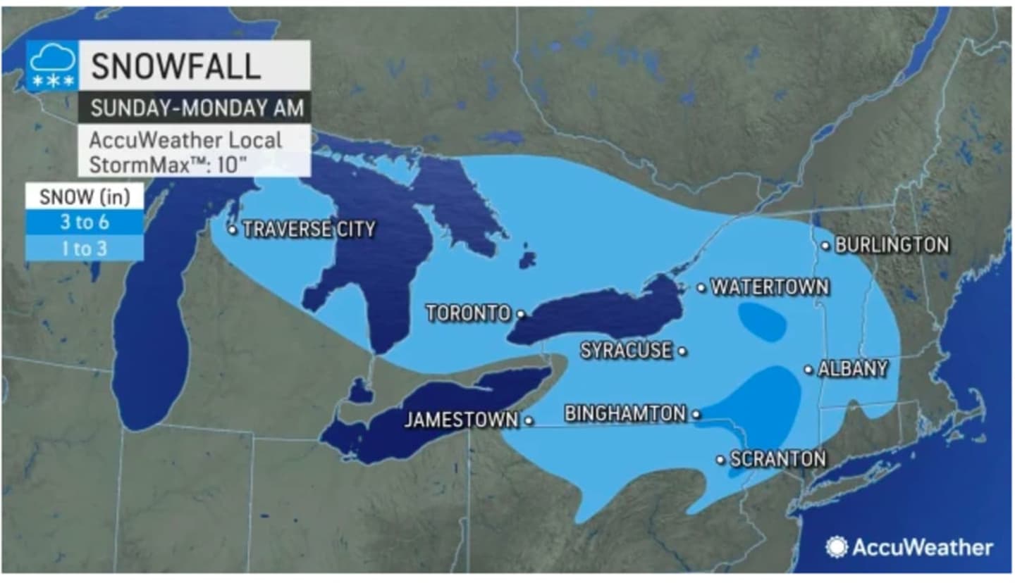
Projected accumulation totals are shown in the first image above from AccuWeather.com with areas in light blue expected to see 1 to 3 inches of snowfall, and 3 to 6 inches forecast for areas in darker blue.
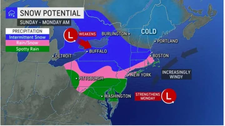
For a look at areas where a mix of rain and snow is possible (shown in pink) and areas where there could be intermittent snow (in blue), click on the second image above.
The days leading up to the system's arrival will be dry with a mix of sun and clouds Friday, Dec. 9, and Saturday, Dec. 10 with a high temperature in the low to mid 40s each day, the National Weather Service says.
A wintry mix and snow are possible in areas where the temperature drops at or below the freezing mark both early Sunday morning as well as after nightfall Sunday.
Precipitation is expected to gradually end by the early overnight hours prior to daybreak on Monday, Dec. 12.
There is still uncertainty surrounding the precise timing, track, and strength of the storm.
Check back to Daily Voice for updates.
Click here to follow Daily Voice Suffolk and receive free news updates.