Newly updated snowfall totals for a winter storm that will hit the East Coast have been released.
The highest snowfall amounts are predicted to be farther south where motorists should "plan on slippery road conditions," the National Weather Service said in a Hazardous Weather Outlook statement issued early Friday morning, Jan. 19. "The hazardous conditions will likely impact the evening commute."
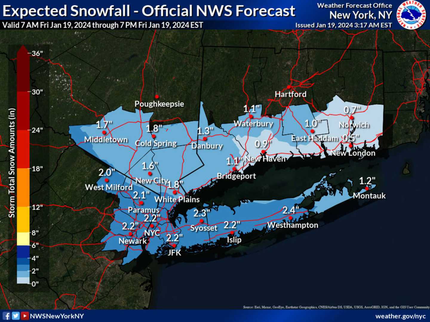
A widespread 2 inches or more of accumulation is predicted for most of Long Island, with less snow in the Hamptons.
Parts of southern Westchester, Rockland, and Orange counties could also see around 2 to 3 inches.
Snowfall is expected to arrive in the Northeast from the south later Friday morning, continue at times during the day, and wind down early Friday evening.
Friday's high temperature will be around 30 degrees.
The weekend will be dry and cold with partly sunny skies Saturday, Jan. 20, and a mix of sun and clouds on Sunday, Jan. 21.
Saturday's high temperature will be in the low 20s with wind-chill values in the single digits. Sunday's high will be in the upper 20s to around 30 degrees.
Check back to Daily Voice for updates.
Click here to follow Daily Voice Suffolk and receive free news updates.