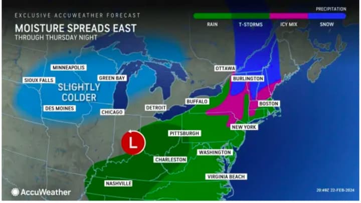
The storm, ignited by a frontal system, arrived around nightfall on Thursday evening, Feb. 22, and wind down Friday afternoon, Feb. 23, according to the National Weather Service.
About a quarter-inch of rain is expected overnight, when pockets of mixed rain and wet snow are possible away from the coast.
Rain will continue throughout the morning Friday before it starts to taper off from west to east in the afternoon after another quarter-inch of new rainfall.
Friday's high temperature will be in the low to mid-40s.
Skies will begin to gradually clear Friday night and it will become colder heading into the week.
Saturday, Feb. 24 will be sunny and brisk with a high temperature holding steady at around the freezing mark.
Skies will stay clear on Sunday, Feb. 25 with a high temperature generally around 40 degrees.
Temperatures will begin to increase starting on Monday, Feb. 26 as the high temperature hits the mid-40s on a partly sunny day.
Check back to Daily Voice for updates.
Click here to follow Daily Voice Scarsdale and receive free news updates.


