It's expected to become a Category 4 hurricane before making landfall near the Texas/Louisiana border late Wednesday night or early Thursday morning, Aug. 27.
A dangerous, "life-threatening storm surge of up to 15 feet" in some places will be accompanied by dangerous wind gusts and waves as well as torrential downpours, the National Hurricane Center said.
Rainfall totals of 5 to 10 inches are expected in parts of Texas and Louisiana, with up to 15 inches in hardest-hit areas.
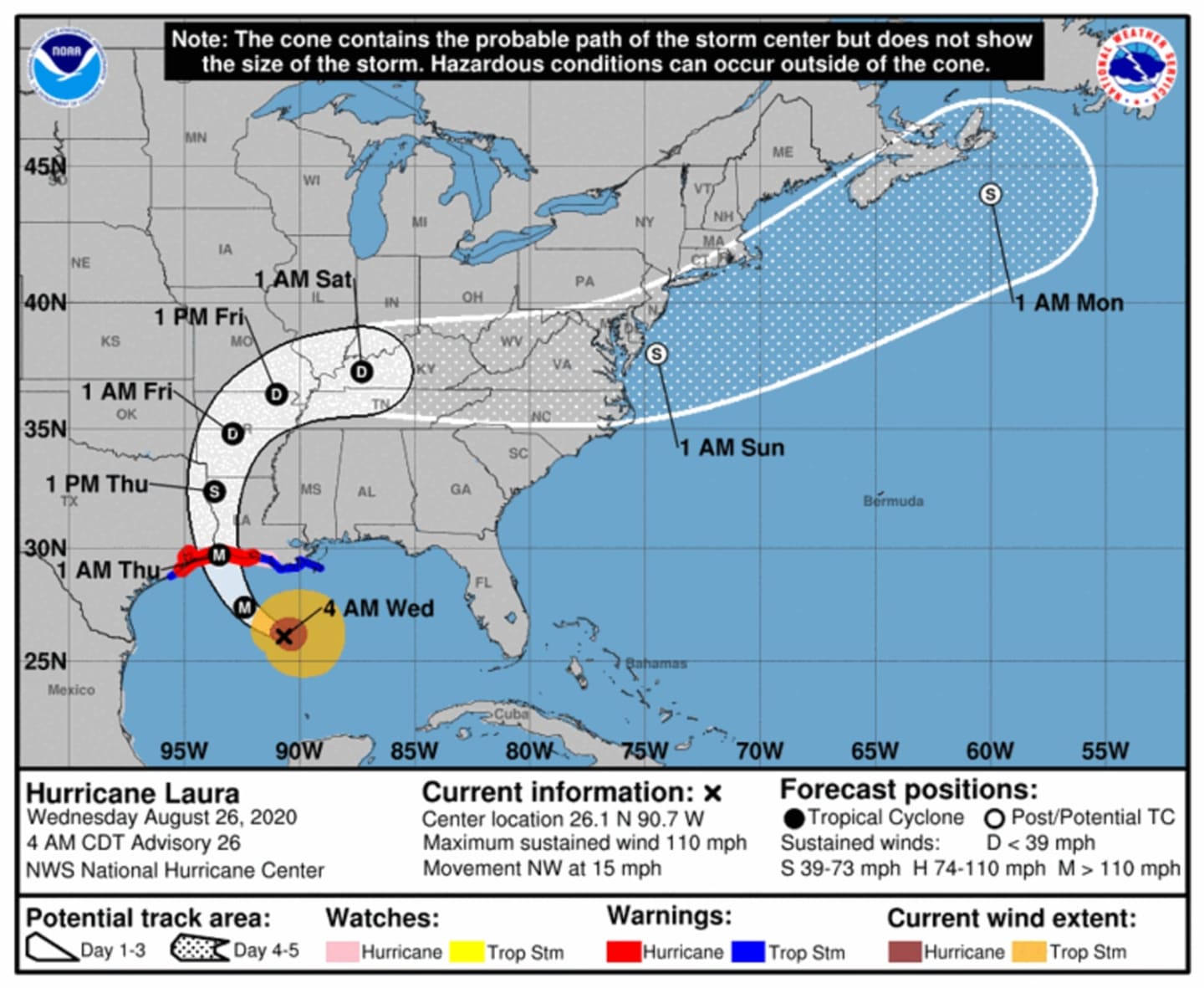
The latest projected path for Hurricane Laura, released at 4 a.m. Wednesday, is shown above. At that time, Laura had winds of 110 mph as a Category 2 storm
After making landfall, the storm is forecast to move north-northeast, losing strength as it moves over land.
Currently, it is projected to move over parts of the Northeast before ending out over the Atlantic on Monday, Aug. 31.
It's too early to predict any possible impacts on the Northeast.
Check back to Daily Voice for updates.
Click here to follow Daily Voice Ramapo and receive free news updates.