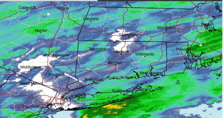
Snow began to fall overnight with most areas seeing an inch or more of accumulation by daybreak on Tuesday, Jan. 16. (For a radar image of the region, see the first image above from the National Weather Service.)
Snow will begin to taper off after daybreak, except in areas farthest north and inland, where 4 to 6 inches of accumulation is possible. Some pockets in northern New England could see 6 inches to a foot of snow. (Click on the second image above from AccuWeather.com.)
Elsewhere, conditions will continue to be icy with a mix of freezing rain and sleet from mid-morning through mid-afternoon Tuesday. Light snow could return later in the afternoon in those spots farther south.
"Plan on slippery road conditions," the National Weather Service said in a Hazardous Weather Outlook statement issued early Tuesday morning. "The hazardous conditions could impact the morning or evening commute."
Tuesday's high temperature will be around 30 degrees with wind-chill values in the upper teens and low 20s.
Precipitation will end by the start of Tuesday evening, which will be cloudy, followed by gradual clearing.
Wednesday, Jan. 17 will be sunny and cold, with a high temperature only in the mid-20s, and wind-chill values in the single digits and teens.
Clouds will return on Thursday, Jan. 18 with a high temperature of around 30 degrees.
A new storm system is now likely for Friday, Jan. 19 with snow expected at times during the day, which will be continued cold with the high temperature below the freezing mark. Snow could continue into the evening on Friday. Possible snowfall accumulations are uncertain.
The system is expected to push out early Saturday morning, Jan. 20, leading to a mostly sunny and blustery day with a high temperature only in the low 20s.
Check back to Daily Voice for updates.
Click here to follow Daily Voice Mahopac and receive free news updates.

