Landfall was around 7 a.m. Monday, Aug. 5 about 70 miles southeast of Tallahassee, the National Hurricane Center said.
It was downgraded to a tropical storm shortly thereafter as it hit Florida's Gulf Coast with flooding rain, damaging winds, and storm surge.
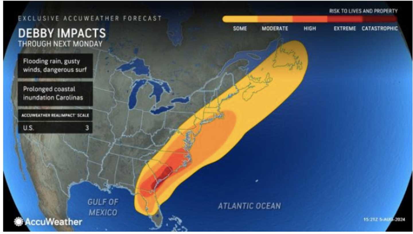
Debby could bring over a foot of rainfall this week to eastern Georgia, South Carolina, and North Carolina, with widespread travel difficulties throughout the Southeast.
The slow-moving system is expected to affect the Northeast later this week, especially southern New England and potentially parts of Long Island.
In the first image above, areas that will experience some impacts are marked in yellow. Areas experiencing moderate impacts are shown in a darker shade of yellow. Highly impacted areas are marked in orange, and extreme impacts are indicated in red.
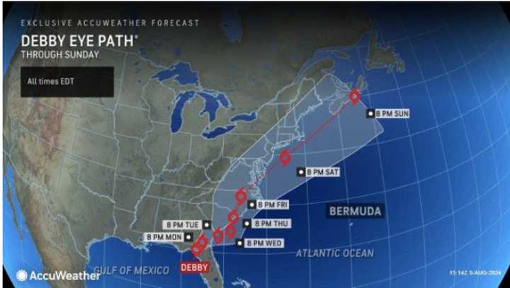
To view Debby's most recent projected path and timing, see the second image above.
Debby was upgraded from a tropical storm to a hurricane at about 11 p.m. Sunday, Aug. 4.
This continues to be a developing story. Check back to Daily Voice for updates.
Click here to follow Daily Voice Mahopac and receive free news updates.