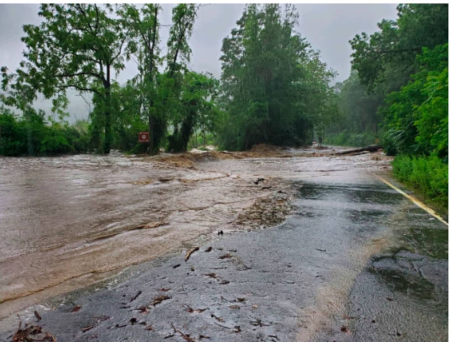
Water rescues have been reported in some parts of the region.
In a new update Monday morning, July 10, state police said troopers have assisted dozens of motorists and are currently doing a check of all remaining vehicles still stranded in the area to ensure that there is no one left behind.
In the Hudson Valley, the New York State Police is asking the public to avoid the Palisades Interstate Parkway in the Rockland/Orange County area due to heavy flooding and washouts. In that area, Route 9W is also experiencing flooding and Route 218 leading into West Point is closed after part of the roadway collapsed.
State Police are also advising motorists to avoid Long Mountain Circle, Route 6, The Bear Mountain Bridge, and Highland Falls, where the William J. Moreau Popolopen Bridge is unpassable, due to "major flooding."
The Palisades Parkway Northbound is closed from Exit 14 to Long Mountain Traffic circle.
State Police issued the initial warning at around 5:30 p.m. Sunday, July 9.
Metro-North says Hudson Line service is suspended between Croton-Harmon and Poughkeepsie in both directions because of flooding.
Other delays are being reported by both Metro-North and Amtrak.
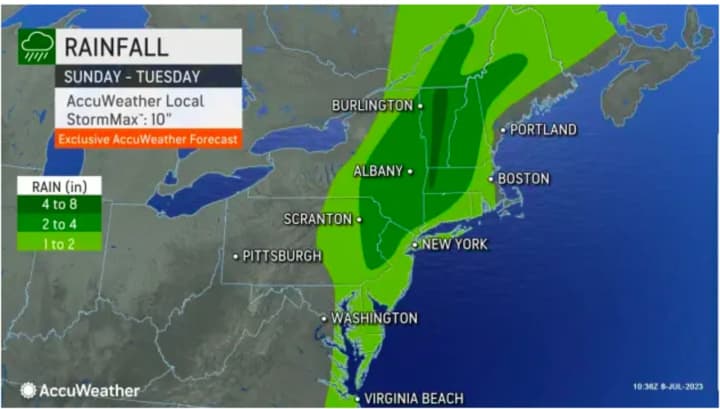
Between 2 and 4 inches of rainfall is expected in areas shown in green in the second image above from AccuWeather.com. Locally higher are possible, especially in areas in darker green.
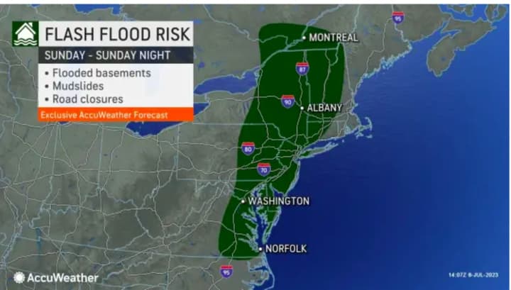
Widespread flood watches have been issued throughout much of the Northeast. Areas most at risk for flash flooding can be seen by clicking on the third image above.
The storm will linger into Monday, July 10 with showers likely and scattered storms possible at any point during the day and night, the National Weather Service says. The high temperature will be around 80 degrees.
Check back to Daily Voice for updates.
Click here to follow Daily Voice Putnam and receive free news updates.