Conditions will remain unsettled on Saturday, April 13 as low pressure begins to pull away from the region, according to the National Weather Service.
Skies will be overcast, and a few scattered showers will be possible at times throughout the day.
Winds will be out of the west between 18 and 22 miles per hour with widespread gusts of 30 miles per hour, and as high as 50 miles per hour in some spots, especially farther inland.
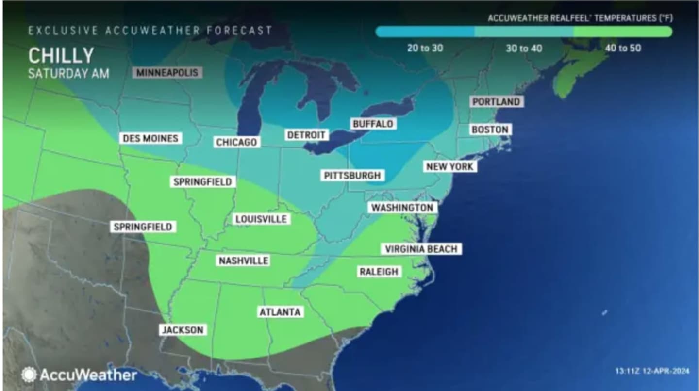
Temperatures are about 5 degrees below average, and the high will be in the low 50s, but because of the strong winds, it will feel like it's in the 30s. (See the image above from AccuWeather.com.)
There could be a passing shower Saturday night and strong wind gusts will remain before skies gradually become mostly clear overnight.
That will lead to a bright, sunny and warmer day on Sunday, April 14 with a high temperature in the mid-60s and calmer winds.
The National Weather Service says an organized line of showers and thunderstorms is expected to develop across central Pennsylvania and western New York and move toward the region Sunday evening.
"Some of the storms when they reach our area may be strong to severe, mainly northwest of NYC," said the weather service. "The main threat will be the strong gusty winds."
The time frame for storm activity is from after nightfall Sunday to the early morning hours of Monday, April 15.
The workweek will start with sunny skies and comfortable temperatures in the mid-60s on Monday, and upper-60s on Tuesday, April 16.
Clouds will return on Wednesday, April 17, with temperatures in the low to mid-60s.
Look for a chance of showers in the afternoon, with showers likely Wednesday night.
Check back to Daily Voice for updates.
Click here to follow Daily Voice Port Chester and receive free news updates.