

The storm is expected to arrive in this region in the overnight hours late Thursday, Feb. 24 into Friday, Feb. 25, with most areas seeing several inches to as much as a half-foot in some spots.
"A wintry mix of snow and sleet is expected to develop Thursday night into early Friday morning," the National Weather Service said in a Hazardous Weather Outlook statement issued early Thursday morning, Feb. 24.
Areas nearest to the coast, including New York City, Long Island and coastal Connecticut, will only see about an inch of snowfall, with a changeover to rain expected by early Friday morning.
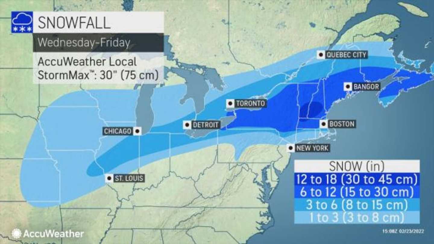
Heavy snow is likely for parts of the Northeast, especially in upstate New York and northern New England, with up to 18 inches possible in northwestern Massachusetts and southern Vermont and New Hampshire, according to AccuWeather.com.
Areas in light blue in the first image above are expected to see 1 to 3 inches, areas in Columbia blue 3 to 6 inches, areas in blue 6 to 12 inches, and areas in Royal blue 12 to 18 inches.
Click on the second image above for a look at the types of precipitation the storm will bring, with rain in green, rain/snow/ice in purple, and snow in blue.
Thursday will be mostly cloudy with a drop in temperatures, as the high will be only in the mid 30s, with wind-chill values between 20 and 30 degrees.
The storm is due to arrive right around midnight Friday with snowfall winding down from west to east starting late Friday morning, followed by a mix of rain and snow, the National Weather Service says. There could be dangerous icy conditions during the morning commute and sleet could be heavy at times during the morning on Friday before the changeover to rain.
Skies will clear Friday night, leading to a mostly sunny day on Saturday, Feb. 26 with a high temperature in the low 30s.
Check back to Daily Voice for updates.
Click here to follow Daily Voice Ossining and receive free news updates.